
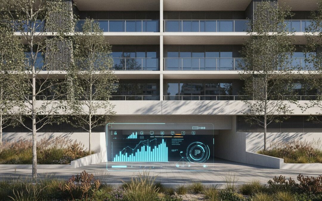
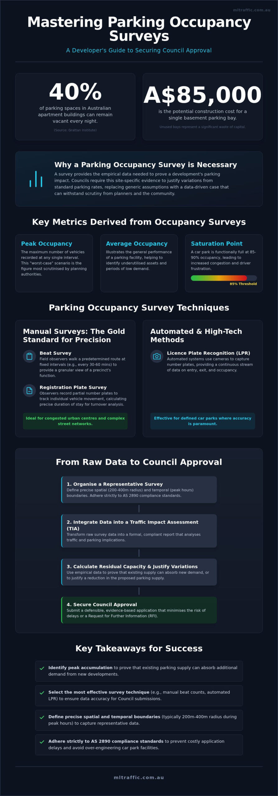
Recent research from the Grattan Institute indicates that up to 40% of parking spaces in Australian apartment buildings remain vacant every night. For developers, this represents a significant waste of capital, especially when a single basement bay can cost upwards of A$85,000 to construct. You likely recognise that presenting a data-driven case for reduced parking is essential for project feasibility, yet many applications fail because the underlying parking occupancy survey techniques are deemed unrepresentative by local authorities. A poorly timed or incorrectly executed survey does more than just delay a project; it undermines your professional credibility with Council planners.
This guide provides the technical clarity needed to secure approval. You’ll learn how to select the most appropriate methodologies to capture accurate, empirical data that stands up to scrutiny. We will detail the differences between manual and automated collection, ensure your data aligns with Australian Standards such as AS 2890.1, and provide a framework for choosing a cost-effective survey strategy. By the end of this article, you’ll understand how to transform raw traffic data into a compliant parking report that supports your development goals.
Key Takeaways
- Identify peak accumulation to prove that existing parking supply can absorb the additional demand generated by new developments.
- Select the most effective parking occupancy survey techniques, such as manual beat counts or automated LPR, to ensure data accuracy for Council submissions.
- Define precise spatial and temporal boundaries, typically within a 200m to 400m radius, to capture representative data during peak usage hours.
- Integrate empirical data into a formal Traffic Impact Assessment to calculate residual capacity and justify variations to standard parking requirements.
- Adhere strictly to AS 2890 compliance standards to prevent costly application delays and avoid over-engineering car park facilities.
What is a Parking Occupancy Survey and Why is it Necessary?
A parking occupancy survey is a systematic methodology used to measure the number of utilised parking spaces within a defined precinct over a set duration. In traffic engineering, these surveys provide the empirical foundation for infrastructure planning and site-specific assessments. It’s not merely a snapshot of a car park. It’s a technical assessment designed to identify peak accumulation. This metric determines whether the existing supply can absorb the additional demand generated by a new development or if the current infrastructure is already at capacity.
Australian Councils frequently demand site-specific data rather than relying on generic rates found in standard planning schemes. This is because theoretical rates often fail to account for local variables like public transport proximity, existing kerbside restrictions, or specific demographic behaviours. Professionals use specific parking occupancy survey techniques to distinguish between total occupancy (the number of vehicles present) and duration of stay (the time each vehicle remains in a bay). Understanding this distinction is vital for an accurate Car Parking Demand Assessment that aims to secure Council approval.
Key Metrics Derived from Occupancy Surveys
Accurate reporting relies on three primary metrics that define the operational capacity of a facility:
- Peak Occupancy: This is the maximum number of vehicles recorded at any single interval. It represents the “worst-case” scenario for the car park and is the figure most scrutinised by planning authorities during the DA process.
- Average Occupancy: This figure illustrates general performance throughout the survey period. It helps identify underutilised assets and periods of low demand across the day or week.
- Saturation Point: A car park is considered functionally full when it reaches 85% to 90% occupancy. Beyond this point, the facility loses efficiency. Drivers spend excessive time circulating for bays, which increases local congestion and frustration.
When Council Requires Empirical Data
Developers usually need to commission a formal survey when proposing a parking shortfall or seeking a “waiver” of standard requirements under a local planning scheme. If you’re changing the land use of a site, such as converting an industrial warehouse into a high-intensity gym or medical centre, the Council will require proof that the local street network can handle the shift in demand. These surveys also serve as a defensive tool during the public notification phase. They provide objective evidence to address community concerns regarding overspill into residential side streets. By using rigorous parking occupancy survey techniques, you replace anecdotal complaints with empirical facts that support your development goals and reduce the risk of a Request for Further Information (RFI).
Manual Survey Techniques: The Gold Standard for Precision
Manual collection provides a level of contextual detail that automated systems often miss. The “Beat Survey” is the primary manual method. It involves field observers walking a predetermined route at fixed intervals, usually every 30 or 60 minutes. This provides a granular view of how a precinct functions over a full business day or weekend peak. While Australian smart parking research continues to explore camera-based alternatives, manual recording remains a reliable way to verify specific bay usage in congested urban centres.
For detailed turnover analysis, we use Registration Plate Surveys. Observers record the last three digits of each number plate. This allows us to track individual vehicle movement and calculate the duration of stay. This technique is ideal for small to medium car parks or complex street networks where line-of-sight is obstructed by trees, building overhangs, or multi-level structures. Using these specific parking occupancy survey techniques ensures that the data submitted to Council is both accurate and defensible.
In larger survey zones, synchronised starts are mandatory. Multiple observers must begin their circuits at the exact same time. This prevents double-counting vehicles that might move between zones during the survey window. Ensuring high-precision data is a core part of our traffic assessment services, as it directly impacts the success of a development application.
The Beat Survey Methodology
The circuit must be designed so the observer completes the loop comfortably within the interval period. If a circuit takes 45 minutes but the interval is 30 minutes, the data integrity is compromised. We’ve moved from paper-based tallies to specialised digital logging apps. These tools offer real-time validation and GPS stamping to ensure observers are at the correct location at the correct time. Manual observers are also significantly better at capturing “illegal” parking. They can identify vehicles in loading zones, on verges, or blocking driveways. Automated sensors often fail to categorise these instances correctly, leading to an underestimation of actual parking demand.
Data Validation and Bias Reduction
Rigorous observer training is essential to minimise human error in digit recording and zone boundary identification. We also account for environmental factors. Surveys are typically avoided during extreme weather events, major local roadworks, or atypical school holiday periods. These conditions produce skewed results that Council will likely reject. Representative data is defined as data collected during a typical peak period for the specific land use. By applying these rigorous parking occupancy survey techniques, we ensure the findings reflect the true operational reality of the site.
Automated and High-Tech Survey Methods
High-tech data collection offers scalability that manual methods cannot achieve, particularly for precinct-wide assessments or 24-hour monitoring periods. While manual beats provide depth in obstructed environments, automated parking occupancy survey techniques are essential for capturing data across vast geographical areas or extended timeframes. The Grattan Institute parking utilisation report demonstrates that residential and commercial parking often remains significantly underutilised. High-tech surveys provide the empirical proof required to challenge mandatory minimums by showing real-time vacancy rates across entire street networks.
Automated systems rely on three primary technologies: License Plate Recognition (LPR), video analytics, and IoT sensors. Each has a specific application depending on the site’s scale and the required data granularity. For large-scale studies where kilometres of kerbside parking must be assessed, LPR is the industry standard. Conversely, for closed car parks or specific intersections, fixed video analytics offer superior accuracy for entry and exit volumes.
License Plate Recognition (LPR) Techniques
Mobile LPR involves mounting high-speed cameras to a survey vehicle. This setup allows technicians to scan thousands of number plates across a wide precinct in a fraction of the time required for a manual walk-through. It’s the most cost-effective method for large-scale urban studies. However, the technology must account for “misreads” caused by obscured plates, heavy rain, or poor street lighting. Professional data cleaning is required to ensure these anomalies don’t skew the final occupancy percentages.
Privacy compliance is a critical factor in LPR deployment. All data collection must align with Australian privacy principles. We ensure that captured images are used solely for calculating occupancy and duration of stay, with all personally identifiable information handled according to strict regulatory standards. This professional approach protects developers from the legal risks associated with large-scale data harvesting.
Fixed Video and Entry/Exit Counting
Cordon counts are used for closed car parks with defined entry and exit points. By deploying temporary poles with AI-integrated cameras, we measure the total volume of vehicles entering and leaving a facility. This method is highly effective for establishing a 24-hour profile of car park usage. Modern software now distinguishes between vehicle classes automatically, separating standard cars from delivery vans and motorbikes. This level of detail is vital for a comprehensive Car Parking Demand Assessment.
The cost-benefit analysis of video analytics often favours automation for multi-day surveys. While the initial hardware setup carries a higher upfront cost than a single manual observer, the reduction in long-term labour costs is significant. For developers, this means more data for less investment over 48 to 72-hour periods. Choosing between manual and automated parking occupancy survey techniques depends entirely on the spatial constraints of your site and the specific temporal requirements of the Council’s brief.
Scoping and Methodology: How to Organise a Representative Survey
A successful survey requires more than just field observations. It demands a rigorous scoping phase to ensure the resulting data withstands Council scrutiny. Without a structured methodology, your data may be dismissed as unrepresentative, leading to costly delays in the DA process. The parking occupancy survey techniques you select must be applied within a strictly defined framework that follows these five essential steps:
- Step 1: Define the Study Area: Establish a radius, typically between 200m and 400m from the site, based on specific Council requirements.
- Step 2: Determine Temporal Scope: Identify peak demand hours. For retail, this is often Saturday midday. For residential or gym uses, weekday evenings are the standard.
- Step 3: Inventory Audit: Conduct a physical count of all legal parking spaces, including time-restricted and permit zones, before occupancy recording begins.
- Step 4: Execute Data Collection: Deploy manual observers or LPR vehicles based on the scale of the precinct and the complexity of the street network.
- Step 5: Data Cleaning: Remove statistical outliers and validate entry and exit balances to ensure the final report is mathematically sound.
Defining the Catchment Area
The 250m “as the crow flies” rule is a common starting point but is often insufficient for a professional assessment. Actual walking distance is the critical metric. Natural and man-made barriers, such as railways, major arterial roads, or rivers, can truncate a parking catchment. If a potential parking bay is separated from the site by a major road without a pedestrian crossing, it cannot be included in the usable supply. You can learn more about how we define these parameters through our Parking Demand Assessment services.
Selecting the Right Survey Days
Council planners generally require data from “typical” periods. This means avoiding school holidays, public holidays, and major local events that skew parking behaviour. For mixed-use developments, a robust TIA often requires at least two or three separate days of data, including a Thursday or Friday and a Saturday. This multi-day approach captures the variance between weekday business peaks and weekend visitor peaks. Selecting the correct days is a vital part of our parking occupancy survey techniques, ensuring the data reflects the true operational reality of the precinct. For a professional traffic impact assessment that meets these rigorous standards, contact our senior engineering team directly.
From Raw Data to Council Approval: Leveraging Survey Results
The final technical requirement for a successful Development Application (DA) is the integration of raw findings into a formal Traffic Impact Assessment (TIA). This document translates vehicle counts into a defensible narrative of capacity and compliance. By applying the parking occupancy survey techniques detailed in previous sections, we calculate “Residual Capacity.” This metric identifies the exact number of legal bays available in the surrounding street network during peak demand, providing the empirical justification required to support a parking shortfall or a reduction in mandatory on-site provision.
Every assessment must align with AS 2890.1 standards to ensure the proposed parking design and demand metrics meet national codes. ML Traffic Engineers Australia ensures that the final report doesn’t merely present raw numbers but interprets them through the lens of regulatory certification. A Senior Traffic Engineer must certify that the methodology is robust enough to withstand peer reviews from Council planners and independent transport consultants. This professional oversight is essential for demonstrating that a development won’t adversely impact local amenity or traffic flow.
Addressing Council Objections
Planning authorities and community groups often raise subjective concerns regarding parking “stress” and overspill. Empirical data is the only effective tool for countering these objections with objective facts. If a survey identifies a 25% vacancy rate during a precinct’s peak hour, community assertions that the area is “full” are mathematically refuted. We use these survey results to draft a Parking Management Plan, which outlines specific mitigation strategies like shared parking or travel demand management. For more on meeting these technical requirements, see our guide on Car Park Design and AS 2890.1 compliance.
The Value of Professional Certification
Data collected by non-experts is frequently dismissed by planning authorities because it lacks the accountability of a qualified professional. Certification by a Principal Traffic Engineer is a standard requirement for DA submissions across Australia. At ML Traffic Engineers Australia, our senior principals are directly involved in certifying the survey methodology and the final data synthesis. This high-level involvement ensures that the parking occupancy survey techniques used are appropriate for the site’s unique land-use profile. Contact ML Traffic Engineers Australia to secure a professional parking assessment that provides a reliable path to Council approval.
Securing Your Development Approval with Empirical Data
Success in the Australian development landscape requires more than just a well-designed building; it demands technical proof that your project integrates seamlessly with existing infrastructure. Selecting the correct parking occupancy survey techniques is the difference between a stalled application and a successful project. By moving beyond theoretical rates and providing empirical evidence of residual capacity, you address community concerns and satisfy Council requirements for reduced parking provisions.
ML Traffic Engineers Australia brings over 15 years of experience to every Car Parking Demand Assessment. We ensure direct senior principal involvement in every project, providing the accountability and technical precision required for AS 2890.1 and AS 2890.2 compliance. Our meticulous approach to data cleaning and professional certification gives your DA the best possible chance of approval without unnecessary delays or over-engineering costs.
Don’t risk a rejection based on unrepresentative data. We’re ready to provide the professional expertise your project needs. Get an Expert Parking Survey for Your DA – Contact Our Senior Engineers to ensure your next development application is supported by robust, defensible evidence. We look forward to helping you achieve a compliant and cost-effective outcome.
Frequently Asked Questions
What is the most accurate parking occupancy survey technique?
Manual registration plate surveys are considered the gold standard for high-precision accuracy in complex urban environments. Unlike automated sensors that may misinterpret obstructed vehicles or fail to categorise illegal parking, trained observers record specific plate digits to verify both occupancy and duration. This method ensures every legal and functional bay is accounted for, providing a level of contextual detail that automated systems often lack during peak periods.
How long does a typical parking survey take to complete for a DA?
The data collection phase usually occurs over two or three separate days to capture representative peak periods. Depending on the development type, this might include a full Thursday, Friday, and Saturday. Once the field work is finished, data cleaning and technical reporting typically take an additional five to seven business days. This timeframe ensures the final submission is robust enough to withstand rigorous Council peer reviews and independent audits.
Does Council accept video-based parking surveys?
Yes, most Australian Councils accept video-based data provided the methodology is certified by a qualified traffic engineer. Video analytics are particularly effective for cordon counts at closed car parks or for 24-hour monitoring. However, the software must be capable of distinguishing between vehicle classes, such as delivery vans and standard cars, to ensure the parking occupancy survey techniques used align with the specific requirements of the local planning scheme.
How much does a professional parking occupancy survey cost in Australia?
Costs vary significantly based on the spatial scale of the precinct and the duration of the monitoring. A basic manual survey for a small site involves different resource allocations compared to complex LPR-based studies for large-scale precincts. Developers should seek a site-specific quote that covers data collection, cleaning, and formal engineering certification. This ensures the survey meets the necessary standards for a successful development application without over-engineering the scope.
What is the difference between a parking accumulation survey and a turnover survey?
An accumulation survey measures the total number of vehicles present at specific intervals to identify peak occupancy. A turnover survey goes further by tracking individual vehicles to determine how long each bay is occupied. While accumulation data establishes if there’s enough supply, turnover data is essential for understanding user behaviour and justifying changes to time restrictions, permit zones, or shared parking arrangements in a TIA.
Why can’t I just count the cars myself for my development application?
Councils require independent, professional certification to ensure the data is unbiased and methodologically sound. Self-conducted counts lack the formal accountability of a Principal Traffic Engineer and are frequently rejected during the peer review process. Professional parking occupancy survey techniques include rigorous data cleaning and validation that a layperson cannot provide, making the final report defensible against community objections or legal challenges in a court environment.
How far from my development site should the parking survey extend?
The survey catchment typically extends 200m to 400m from the site boundaries, though this depends on specific local Council guidelines. This distance represents a reasonable walking catchment for most land uses. The study area must also account for natural barriers, such as major arterial roads or railways, that might prevent drivers from using certain streets, ensuring the “usable” supply is accurately represented in the final report.
What happens if the survey shows the car park is already full?
High occupancy doesn’t automatically lead to a DA rejection, but it does require a strategic response. We use the data to develop a formal Parking Management Plan, which might include shared parking arrangements, staggered operational hours, or improved end-of-trip facilities. Demonstrating that the development will implement active travel measures or demand management strategies can often mitigate the impact of existing parking stress and satisfy the Council’s planning requirements.

Disclaimer
The content on www.mltraffic.com.au, including all technical articles, guides, and resources, is provided for general informational and educational purposes only. It is not intended to constitute professional advice in traffic engineering, transportation planning, development approvals, or any other technical or legal field.
While ML Traffic Engineers makes every reasonable effort to ensure the accuracy, completeness, and timeliness of the information published, we do not provide any warranties or representations (express or implied) regarding its reliability, suitability, or availability for any particular purpose. Any reliance you place on the content is strictly at your own risk.
In no event shall ML Traffic Engineers, its directors, employees, authors, or affiliates be liable for any direct, indirect, incidental, special, consequential, or punitive damages (including, without limitation, loss of profits, data, or business opportunities) arising out of or in connection with the use of, or inability to use, any information provided on this website.
The articles and guides on this site are not a substitute for engaging a qualified, registered professional traffic engineer (such as an NPER or RPEQ engineer) to assess your specific project requirements. For tailored advice, compliance assessments, or traffic engineering services, please contact a competent professional.
This disclaimer may be updated from time to time without notice. By accessing or using this website, you agree to be bound by the most current version of this disclaimer.
