
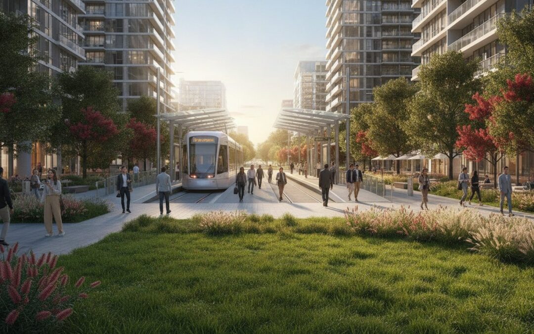
Every square metre dedicated to redundant car parking is a square metre of lost profit. While many developers view transit proximity as a marketing perk, the real value lies in leveraging that location to secure Council approvals for higher density and lower parking ratios. Successfully integrating developments with public transport networks requires more than just being near a bus stop; it demands a calculated engineering strategy that satisfies complex state and local planning policies.
You likely understand the frustration of Council pushback regarding traffic generation and the high costs of providing excessive on-site parking. This guide provides the technical roadmap to align your project with Australian transit networks, ensuring you satisfy Council requirements while optimising site yield. We’ll detail how professional Traffic Impact Assessments (TIAs) and parking demand data support transit-oriented outcomes and help you achieve a favourable Development Application (DA) result.
Key Takeaways
- Understand how Transit-Oriented Development (TOD) creates a functional link between private sites and public infrastructure to maximise site yield.
- Learn the engineering strategies for integrating developments with public transport networks to justify higher density and lower parking ratios.
- Discover how to use Australian Standard AS 2890.1 and Car Parking Demand Assessments to reduce the space and cost of on-site car parks.
- Identify the five critical steps to organise a transit-integrated project, from preliminary site audits to final expert consultation.
- Gain insights into quantifying walkability and transit capacity to successfully overcome Council pushback regarding traffic generation.
What Does Integrating Developments with Public Transport Networks Mean?
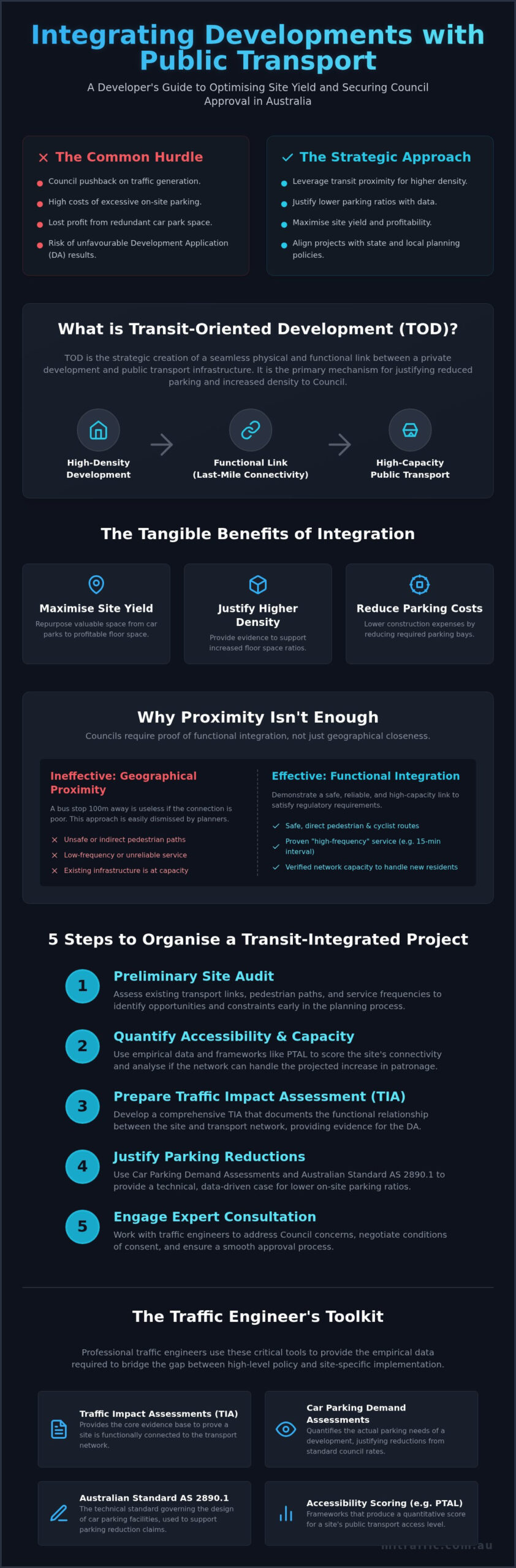
Transport integration is the seamless physical and functional link between a private development and public infrastructure. It’s a fundamental requirement for modern urban planning. In an Australian context, this is often formalised through Transit-oriented development (TOD). TOD focuses on creating high-density, mixed-use areas within walking distance of high-capacity transit nodes. For a developer, integrating developments with public transport networks is the primary mechanism for justifying reduced parking rates and increased floor space ratios.
Councils prioritise “last-mile” connectivity. They look for developments that facilitate safe and efficient movement for pedestrians and cyclists between the site and the transport interchange. Documenting this relationship is a core component of a Traffic Impact Assessment. When integrating developments with public transport networks, the TIA must demonstrate that the proposed density aligns with the actual capacity of the surrounding infrastructure. A TIA provides the evidence required to show that a site is functionally connected to the broader network, rather than just being geographically adjacent to it.
In Australia, state-level planning policies often mandate specific TOD requirements that override local council parking minimums. However, the burden of proof remains with the developer. A TIA serves as this evidence base, providing a technical justification for why a specific site can operate with fewer parking bays. It bridges the gap between high-level policy and site-specific implementation, ensuring that the development doesn’t place undue pressure on the local road network.
The Functional Goals of Integration
Integration aims to achieve several technical outcomes. Primarily, it reduces the reliance on private vehicle trips for daily commuting. This shift is essential for managing urban growth within existing road capacities. Effective integration encourages residents to use state-funded infrastructure like trains and buses. It improves site accessibility without contributing to road congestion or requiring excessive on-site car parking. This approach optimises site yield by repurposing space that would otherwise be lost to car park ramps.
Why Proximity is Not Enough
Site location is only the first step. A bus stop located 100 metres from a site entrance is ineffective if the pedestrian path is unsafe or indirect. True integration requires a detailed assessment of network frequency and capacity. Councils often require proof of “high-frequency” status, such as a 15-minute service interval, before granting density bonuses. We assess walking routes and service reliability to ensure the integration is functional rather than just geographical. If the infrastructure is at capacity, proximity alone won’t satisfy regulatory requirements.
The Role of Traffic Engineering in Transit Connectivity
Traffic engineering provides the empirical data required for integrating developments with public transport networks. Without technical quantification, claims of “transit-friendly” design remain anecdotal and are easily dismissed by planning authorities. Historically, the failure of integrating transportation and land use has resulted in inefficient urban centres and high infrastructure costs. Professional engineers bridge this gap by calculating the precise relationship between a site and its surrounding transit infrastructure, using metrics like service frequency, reliability, and network reach.
We analyse existing bus and train line capacities to determine if the network can accommodate the projected increase in patronage. This analysis identifies the need for targeted infrastructure upgrades that Councils often demand as a condition of consent. These might include signalised pedestrian crossings, improved street lighting, or upgraded bus shelters. By addressing these gaps early, developers can mitigate Council concerns regarding “last-mile” connectivity. This data also supports the development of a robust Traffic Management Plan during the construction phase. It ensures that heavy vehicle movements and site access points don’t disrupt established transit corridors or pedestrian safety.
Quantifying Public Transport Accessibility
Engineers use frameworks like the Public Transport Accessibility Level (PTAL) to score a site’s connectivity. We measure actual walking distances to the nearest node, accounting for physical barriers, signalised wait times, and topography. This is far more accurate than “as the crow flies” metrics which ignore the reality of the urban environment. We also evaluate the “interchange” experience, assessing whether the transition from the site to the platform is safe, accessible, and intuitive for the end-user. High accessibility scores are critical for justifying density increases and parking variations.
Mitigating Traffic Impacts Through Transit
A primary goal of integrating developments with public transport networks is the reduction of total vehicle trips. We calculate specific trip generation rates that reflect the lower car ownership typically found in transit-rich areas. This reduction is then verified through detailed Intersection Analysis. This analysis demonstrates to Council that the development will not exceed the capacity of the local road network. By proving a lower impact on intersections, developers can often negotiate significant reductions in required car parking spaces. For projects requiring this level of technical rigour, consulting with the senior principals at ML Traffic Engineers ensures your data meets all regulatory standards.
Justifying Parking Reductions with Public Transport Access
Integrating developments with public transport networks provides a technical basis for reducing on-site parking requirements. When a site is located near high-frequency transit, the statistical demand for private vehicle storage drops significantly. We use Car Parking Demand Assessments to prove this correlation to Councils, often achieving variations to standard planning controls. This evidence-based approach is frequently supplemented by a Green Travel Plan. These plans are often a condition of consent, detailing how the development will encourage sustainable transport through car-share pods, bike storage, and real-time transit information displays.
The Economics of Reduced Parking
Basement excavation is a capital-intensive process. The cost of providing multiple levels of underground parking can jeopardise the feasibility of a project. By integrating developments with public transport networks, developers can repurpose space for additional residential or commercial floor area. This increases the total site yield and improves the project’s financial viability. We focus on balancing the needs of visitors with resident transport options to ensure the site remains functional without being over-parked. This strategic reduction in parking bays directly lowers construction costs while meeting market demand for transit-connected living.
Compliance with AS 2890 and Local Policies
Reducing the number of parking bays doesn’t permit a reduction in design quality. A compliant Car Park Design must still meet AS 2890.1 requirements for aisle widths, ramp grades, and bay dimensions. Councils are typically concerned that parking shortfalls will result in residents parking on surrounding residential streets. Our assessments provide the data to refute these concerns, showing that transit-proximate residents simply own fewer cars. In the constrained footprints typical of transit-integrated sites, Swept Path Analysis is a critical tool. It verifies that service vehicles and cars can navigate the site safely, maintaining operational efficiency without wasting valuable land.
5 Steps to Organise a Transit-Integrated Development
Integrating developments with public transport networks isn’t just a design preference; it’s a regulatory necessity for high-yield projects. This process requires a structured approach that begins during the feasibility phase and concludes with a formal submission to Council. By documenting the functional relationship between your site and the existing network, you can justify the parking variations needed to make a project viable. A successful integration strategy ensures that every claim regarding reduced traffic generation is backed by technical engineering data.
Step 1: The Transport Audit
Mapping existing infrastructure is the first priority. We identify every transit node within an 800-metre radius of the site boundary, which is the standard accepted walking distance for most Australian planning authorities. This audit includes checking timetable frequencies during morning and afternoon peak periods to confirm “high-frequency” status. We also locate active transport links, such as regional cycleways or shared paths, which contribute to the site’s overall accessibility score and support a reduction in car dependency.
Step two involves early consultation with a traffic engineer. You should determine realistic parking variations before the architectural design is locked in. Locking in a basement layout without assessing actual transit capacity often leads to costly redesigns if Council doesn’t accept your initial parking provision. Our senior principals provide direct advice on what variations are achievable based on current local and state policies.
Step three focuses on pedestrian connectivity. You must design safe, direct, and accessible pathways that provide a seamless link to the nearest transport nodes. Council will scrutinise the “walkability” of these routes. If the path to the train station is indirect or poorly lit, your transit-integration claims will carry less weight. We assess these routes to ensure they meet the requirements for universal access and safety.
Step 4: End-of-Trip Facilities
Bicycle parking is now a non-negotiable requirement for transit-integrated Development Applications. Modern developments must cater for the rise of e-bikes, which requires dedicated charging infrastructure and secure storage areas. These facilities must align with specific state planning requirements and the expected resident or employee profile. Providing high-quality change rooms and lockers further reduces the demand for on-site car parking by supporting multi-modal commuting. If you don’t account for these facilities early, you’ll struggle to meet the increasingly strict “active transport” quotas set by local Councils.
The final step is formalising the strategy in a comprehensive Traffic Impact Assessment report. This document synthesises audit data, parking demand analysis, and design features into a technical argument for Council. At ML Traffic Engineers, our senior principals perform all technical work personally to ensure your submission meets the highest regulatory standards. For expert guidance on integrating developments with public transport networks, contact us directly to discuss your project requirements.
How ML Traffic Engineers Australia Supports Transit Integration
ML Traffic Engineers Australia provides the technical rigour required for integrating developments with public transport networks. We have over 15 years of experience in Australian traffic planning and consultancy. Our approach focuses on direct accountability and results-oriented assessment. When you engage our firm, you deal directly with senior principals who perform all technical work personally. We don’t use junior staff or account managers as gatekeepers. This ensures that the expert who initiates the client relationship is the one performing the site assessments and engineering calculations. This professional continuity is a core signature of our firm, distinguishing us from larger, more impersonal consultancies.
We understand the bureaucratic requirements of local Councils and state planning departments across all Australian jurisdictions. ML Traffic Engineers Australia has a proven track record of negotiating favourable parking conditions by leveraging transit proximity. We provide the technical justification needed to overcome traffic generation concerns and parking shortfalls. This involves delivering specialised Car Parking Demand Assessments that reflect real-world usage patterns rather than generic estimates. The involvement of senior leadership in every project reinforces a personality of reliability and deep-seated expertise. Our messaging is based on demonstrated knowledge and regulatory compliance.
Our Expertise in TIA Reports
Preparing detailed Traffic Impact Assessment (TIA) reports is our core capability. These reports highlight the specific transit benefits of your project, providing a clear roadmap for Council approval. We specialise in defending parking demand variations with data-driven evidence, such as local patronage rates and service frequency analysis. This technical rigour is essential for integrating developments with public transport networks effectively. Our reports meet the rigorous standards of Australian planning authorities and adhere to national regulatory guidelines. We integrate findings from related assessments, including Swept Path Analysis and Car Park Design according to AS 2890, to provide a comprehensive submission. This meticulous documentation minimises the risk of Council requests for further information (RFIs) and accelerates the DA process.
National Coverage and Professional Reliability
ML Traffic Engineers Australia supports developments across all Australian states and territories. We maintain a consistent standard of service regardless of project location or scale. Our personnel continuity promise means the person who understands your site’s unique challenges remains on the project until completion. This accountability is a unique voice marker of our firm. Our project experience spans a diverse range of land-use categories, including residential flat buildings, mixed-use towers, and commercial hubs. We provide dependable, results-oriented advice that avoids unnecessary bureaucracy. If you require expert assistance with site assessments or infrastructure design, our senior team is ready to provide qualified consultancy. Contact our team to discuss your transit integration strategy and ensure your development achieves its maximum potential yield.
Maximising Site Potential Through Strategic Integration
Successful project outcomes depend on more than just proximity to a train station. You must provide a technical evidence base that justifies your design choices and parking provisions. By integrating developments with public transport networks, you can significantly reduce basement excavation costs and increase saleable floor area. This requires a professional Traffic Impact Assessment that translates transit accessibility into a compliant, data-driven argument for Council approval.
ML Traffic Engineers Australia offers over 15 years of industry experience in Australian traffic planning. We provide direct access to senior principal engineers for all technical work, ensuring your project receives the highest level of expert oversight. Our national coverage spans all Australian Councils, providing reliable results for diverse project environments. We don’t use junior staff as gatekeepers; the expert you start with is the person performing your assessment. Contact ML Traffic Engineers Australia for an Expert TIA Report to discuss your site’s specific requirements. We look forward to helping you achieve a favourable DA result.
Frequently Asked Questions
How close does my development need to be to public transport to reduce parking?
Most Australian planning authorities consider a distance of 400 to 800 metres as the standard walkable catchment for transit integration. Proximity alone is insufficient; the transport node must offer frequent and reliable services. A Traffic Impact Assessment quantifies these distances and service frequencies to justify parking variations. Being within these catchments allows developers to technically argue for a reduction in on-site parking based on lower resident car ownership.
What is a Green Travel Plan and do I need one for my DA?
A Green Travel Plan is a suite of operational measures designed to encourage sustainable transport use. It is often required for developments seeking significant parking shortfalls. These plans include provisions for car-sharing pods, subsidised transit passes, or real-time travel information displays in foyers. Councils frequently mandate these as a condition of consent to ensure that integrating developments with public transport networks results in a measurable mode shift.
Can a Traffic Impact Assessment help me get more units on my site?
Yes, a TIA can help maximise site yield by justifying a reduction in the space required for car parking. When a report proves that transit connectivity reduces parking demand, you can repurpose basement or podium levels for additional saleable units. This optimisation of floor space is a primary commercial benefit of transit integration. Our senior principals specialise in providing the technical data required to support these density increases.
Is a bus stop considered high-frequency transport in Australia?
It depends entirely on the specific service interval during peak periods. Most Councils define high-frequency as a service running every 15 minutes or less. A standard bus stop with hourly services will not typically support significant parking reductions or density bonuses. We assess specific route timetables and network capacity to determine if the existing infrastructure meets the technical threshold required for parking variations in your local government area.
How do I prove that residents will actually use public transport instead of cars?
We use empirical data from similar transit-oriented developments and census car-ownership statistics to build a technical case. By comparing your site to established projects in comparable transit corridors, we provide evidence that residents in these locations own fewer vehicles. This data-driven approach replaces assumptions with technical facts. It demonstrates to Council that the proposed parking provision aligns with the actual needs of the future demographic, mitigating concerns about overflow.
What are end-of-trip facilities and why are they required for integration?
End-of-trip facilities include secure bicycle storage, showers, and lockers. They are essential for supporting active transport as part of a broader integration strategy. Many Australian planning codes now mandate specific quotas for these facilities, particularly in commercial or mixed-use developments. By providing high-quality facilities, you support multi-modal commuting. This strengthens the technical argument for reduced car parking, as residents and employees have viable, non-vehicular alternatives for their daily commute.
Does integrating with transport networks increase the value of a development?
Integrating developments with public transport networks typically increases both capital value and rental yield. Transit-proximate properties are in higher demand due to lower commuting costs and better accessibility to employment hubs. From a developer’s perspective, value also increases through reduced construction costs. Spending less on deep basement excavation for car parks directly improves project margins while delivering a product that aligns with modern urban living preferences and sustainability goals.
Will Council accept a parking shortfall if I am near a train station?
Council will generally consider a shortfall only if it is supported by a professional Car Parking Demand Assessment. Proximity to a train station is a strong starting point, but you must prove that the specific shortfall will not impact local street amenity. We provide the technical rigour to show that the proposed parking rate is sufficient for the development’s use. This involves a detailed analysis of local parking availability and transit capacity.

Disclaimer
The content on www.mltraffic.com.au, including all technical articles, guides, and resources, is provided for general informational and educational purposes only. It is not intended to constitute professional advice in traffic engineering, transportation planning, development approvals, or any other technical or legal field.
While ML Traffic Engineers makes every reasonable effort to ensure the accuracy, completeness, and timeliness of the information published, we do not provide any warranties or representations (express or implied) regarding its reliability, suitability, or availability for any particular purpose. Any reliance you place on the content is strictly at your own risk.
In no event shall ML Traffic Engineers, its directors, employees, authors, or affiliates be liable for any direct, indirect, incidental, special, consequential, or punitive damages (including, without limitation, loss of profits, data, or business opportunities) arising out of or in connection with the use of, or inability to use, any information provided on this website.
The articles and guides on this site are not a substitute for engaging a qualified, registered professional traffic engineer (such as an NPER or RPEQ engineer) to assess your specific project requirements. For tailored advice, compliance assessments, or traffic engineering services, please contact a competent professional.
This disclaimer may be updated from time to time without notice. By accessing or using this website, you agree to be bound by the most current version of this disclaimer.
