

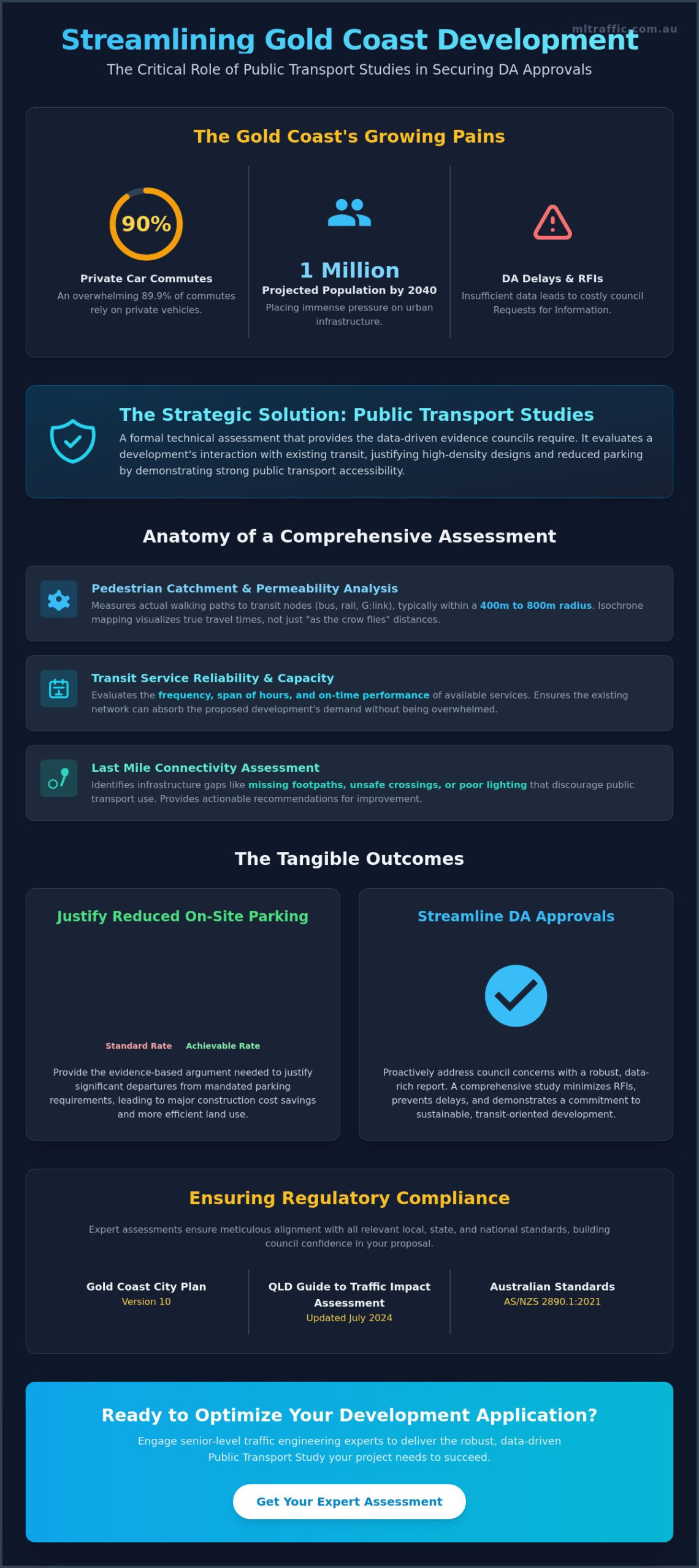
With 89.9% of Gold Coast commutes currently made by private car and the population projected to reach 1 million by 2040, the pressure on urban infrastructure is reaching a critical threshold. You’re likely aware that securing a Development Application (DA) approval often hinges on balancing high-density yields with strict parking and access regulations. Insufficient data frequently leads to lengthy delays and frustrating Requests for Information (RFI) from council. This article explains how professional public transport studies gold coast facilitate faster approvals and provide the technical justification needed to reduce on-site parking requirements. By integrating these assessments early, you ensure your project aligns with the Gold Coast City Plan Version 10 and the latest Queensland Guide to Traffic Impact Assessment, updated in July 2024.
We’ll examine how detailed transport data justifies departures from standard parking rates, especially in light of the $543 million infrastructure budget for 2026-27. This guide previews the methodology required to achieve a compliant, cost-effective development design that meets national regulatory standards like AS/NZS 2890.1:2021. Our focus is on providing the authoritative data necessary to streamline your DA process and optimise urban outcomes. We understand the technicalities of the “More GO” Public Transport Program and the Infrastructure Australia investment priorities, ensuring your submission is robust, meticulous, and results-oriented.
Key Takeaways
- Define the role of technical assessments in evaluating existing network capacity versus proposed demand for streamlined DA approvals.
- Explore the use of isochrone mapping and pedestrian permeability analysis within professional public transport studies gold coast to establish accurate site catchments.
- Learn how evidence-based arguments for high transit accessibility can justify significant reductions in mandated on-site parking requirements.
- Understand the integration of transport data with traffic engineering to meet Australian Standards and satisfy council-specific access regulations.
- Recognize the value of senior-level consultancy and personnel continuity in ensuring technical reports withstand rigorous local government scrutiny.
What is a Public Transport Study in Australian Urban Planning?
A public transport study is a formal technical assessment required for Development Applications (DA) in Australia. It serves as a data-driven evaluation of how a proposed development interacts with existing transit infrastructure. Unlike generic maps, these studies quantify the relationship between a site’s projected demand and the available network capacity. In the context of transportation planning, these documents provide the evidentiary basis for high-density yields and infrastructure contributions. The assessment ensures that a project doesn’t overwhelm existing services while identifying opportunities for transit-oriented growth.
Professional public transport studies gold coast are critical due to the city’s rapid population growth and the specific requirements of the Gold Coast City Plan Version 10. While frequently integrated into a broader Traffic Impact Assessment (TIA) Report, these studies often function as standalone justifications for urban intensification. They move beyond basic vehicle counts to assess how effectively residents or customers can access a site without relying on private cars. This distinction is vital for developers who need to justify specific design choices to local councils and state authorities.
To better understand how these systems operate on the ground, watch this helpful video:
The Core Objectives of Transport Analysis
The primary objective is to demonstrate that a development is sustainable within the existing transit framework. This requires meticulous data collection and analysis. Key focus areas include:
- Walking Distance: Measuring actual pedestrian paths to high-frequency transit nodes, typically within a 400m to 800m radius.
- Service Reliability: Evaluating the frequency, span of hours, and reliability of bus, rail, or G:link light rail services.
- Last Mile Connectivity: Identifying infrastructure gaps that might prevent future residents from using public transport, such as missing footpaths or inadequate lighting.
When is a Formal Study Required?
Councils mandate these studies based on specific triggers related to scale and location. Projects in high-growth corridors or those seeking to deviate from standard regulations must provide these assessments. Common triggers include:
- Residential developments exceeding density thresholds or commercial projects with significant floor space in metropolitan areas.
- Developments located within Principal Centre or Specialised Centre zones where transit-oriented development is prioritized.
- Applications seeking a variation to standard parking rates under local planning schemes, often requiring a Car Parking Demand Assessment.
Adherence to the Queensland Guide to Traffic Impact Assessment, updated July 9, 2024, is mandatory for these technical submissions. Meticulous alignment with these standards prevents costly RFIs and ensures the DA process remains streamlined.
Key Components of a Comprehensive Transport Access Assessment
A rigorous assessment begins with a technical desktop analysis of the state-wide transit network. This process evaluates current infrastructure against the Gold Coast Public Transport Plan 2018–2028 to ensure site-specific proposals align with long-term council objectives. Professional public transport studies gold coast must account for the $337 million allocated in the 2026-27 budget for road and public transport connectivity improvements. This data-driven approach establishes a baseline for network capacity and future service expansion.
Safety and accessibility audits are mandatory for all transit-bound pedestrian paths. These audits assess lighting, surveillance, and compliance with disability access standards to ensure safe movement between the site and transit nodes. We also review the 2-5 year infrastructure pipeline, specifically the “More GO” Public Transport Program (2026-2028). This provides a forward-looking view of site accessibility as the city’s population grows toward the projected 1 million by 2040. For complex developments, integrating a Vehicle Swept Path Analysis ensures that service vehicles do not compromise these critical pedestrian zones.
Mapping the Catchment Area
Access is defined by permeability, not just proximity. Technical assessments define 400m and 800m walking catchments using isochrone mapping. This illustrates actual travel times rather than simple radius circles. The analysis identifies topographical barriers, such as steep gradients or missing crossings, that impede pedestrian flow. High-density yields are only defensible when these catchments are proven to be accessible and safe for the intended demographic.
Service Frequency and Capacity Review
Reliability is quantified by service density during AM and PM peak periods. Assessments calculate the number of unique services per hour to determine if the development will contribute to crush capacity on local bus or light rail routes. If existing capacity is insufficient, the study must propose mitigation strategies. These may include infrastructure contributions or travel demand management plans. This level of detail is necessary to satisfy the Queensland Guide to Traffic Impact Assessment requirements updated on July 9, 2024. Meticulous data prevents the RFIs that often delay DA approvals.
Council Compliance: Integrating Studies with Traffic Engineering
Council compliance requires a seamless integration of technical data into the formal planning package. Meticulous public transport studies gold coast ensure that every transport-related claim in the Statement of Environmental Effects (SEE) is supported by empirical data. This alignment is critical for demonstrating that a proposal is sustainable and won’t negatively impact the existing road network. We focus on meeting the rigorous requirements of Australian Standards, specifically AS/NZS 2890.1:2021 for parking and access, to provide a compliant and cost-effective design.
Insufficient data is the primary cause of Request for Information (RFI) delays during the DA process. Council officers require definitive evidence that a development aligns with the Gold Coast City Plan Version 10 and the Queensland Guide to Traffic Impact Assessment, updated on July 9, 2024. By delivering authoritative reports that address specific Performance Outcomes (PO) and Acceptable Outcomes (AO), we remove the guesswork for assessing officers. This proactive approach minimizes administrative bottlenecks and accelerates the path to approval.
Aligning with National Planning Policies
Technical assessments must reflect the broader objectives of the National Urban Policy and Net Zero Roadmaps. Our studies maintain consistency with Infrastructure Australia’s 2026 investment priorities, which emphasize high-capacity transport for growing cities. A Traffic Impact Assessment integrates public transport data to satisfy regulatory standards by validating that a site’s multimodal accessibility justifies reduced road network impacts and parking provisions. This ensures your project is positioned within the context of state-based infrastructure priority lists and national sustainability targets.
Navigating Local Planning Schemes
Interpreting transport-related codes in local government planning documents requires seasoned expertise. When a development cannot meet a standard Acceptable Outcome, such as a rigid parking ratio, we must justify an “alternative solution” through technical analysis. This involves a deep dive into the specific transport codes applicable to the site’s zone. Traffic Impact Assessments are essential tools in this process, providing the engineering justification needed to achieve compliance while maximizing development yields. We provide the meticulous documentation required to prove that your project meets the intent of the planning scheme, even when departing from standard codes.
Reducing Parking Demand through High Transport Accessibility
Reducing on-site parking is a primary financial driver for modern urban developments. Excavating for basement parking can cost tens of thousands of dollars per bay, often making high-density projects unviable. Professional public transport studies gold coast provide the empirical evidence needed to justify a departure from standard parking ratios. By proving a site’s high accessibility to the G:link light rail or high-frequency bus corridors, developers can negotiate significant reductions in mandated parking numbers. This shift reflects the 44% projected increase in trips on the Gold Coast by 2031, necessitating a move away from car-centric design.
Arguments for reduction must be evidence-based and meticulously documented. We analyze car ownership rates in similar transit-oriented developments (TODs) to demonstrate that residents in these zones own fewer vehicles. Shared parking arrangements and unbundled parking, where spaces are sold or leased separately from the dwelling unit, further optimize the use of limited site area. These strategies are particularly effective in areas with high active transport targets, such as the Gold Coast’s goal of a 12% active transport mode share by 2026.
Car Parking Demand Assessments
A technical Car Parking Demand Assessment is essential for projects seeking variations to the Gold Coast City Plan Version 10. We apply AS 2890.1 standards to ensure that even with a reduced number of bays, the layout remains functional and compliant. Our assessments calculate parking credits based on proximity to high-frequency rail nodes, using data verified against the Queensland Guide to Traffic Impact Assessment, updated July 9, 2024. This technical justification is the difference between a rejected DA and a cost-effective, approved design that maximizes yield while minimizing construction overheads.
Implementing Green Travel Plans
Green Travel Plans (GTP) serve as a formal commitment to reducing private vehicle reliance. These plans include specific end-of-trip facilities such as secure bike lockers, showers, and repair stations, which are now standard requirements for many commercial and high-density residential DAs. By incentivizing residents and employees to utilize the “More GO” program services, developers meet council sustainability targets. These plans often include ongoing monitoring and reporting requirements to ensure post-completion compliance with mode-share goals. A well-structured GTP reinforces the findings of the broader transport study and provides council with confidence in the project’s long-term sustainability.
If you need to justify a reduction in on-site parking for your next project, contact our senior traffic engineers to discuss a tailored Car Parking Demand Assessment.
Engaging Expert Traffic Engineers for Transport Studies
Securing a DA approval for high-density projects requires technical documentation that withstands rigorous cross-examination by local authorities. Many public transport studies gold coast are rejected because they lack the necessary professional engineering oversight. ML Traffic Engineers Australia provides the RPEQ-level certification required to validate transit demand and network capacity assessments. This level of technical rigour is essential for reports that must satisfy complex council performance outcomes.
Senior-level involvement is critical for establishing report credibility with council assessing officers. When a principal engineer signs off on a technical study, it signals a commitment to data integrity and national regulatory compliance. This expertise is particularly vital when reconciling the often-conflicting requirements of vehicle access, pedestrian safety, and transit proximity. Our authoritative approach ensures that every assessment is defensible during the planning process.
Accountability is maintained through our personnel continuity promise. The senior consultant who initiates the project performs the technical analysis and remains the primary point of contact until the final determination. This “no-gatekeepers” approach ensures that site-specific nuances identified during feasibility are accurately reflected in the final submission. It distinguishes our consultancy from larger, impersonal firms where project knowledge is often lost between departments.
The ML Traffic Engineers Australia Advantage
With over 15 years of consultancy experience in the Australian transport sector, we understand the technicalities of urban planning codes. We offer a direct line to senior principals, ensuring every report is meticulous and results-oriented. Our comprehensive service suite includes:
- Detailed Swept Path Analysis for transit and service vehicles.
- Full Traffic Impact Assessment (TIA) Reports.
- Car Parking Demand Assessments for reduced-scale designs.
- Intersection Analysis and Sight Distance Assessments.
Streamlining Your DA Approval
Robust technical studies pre-empt council objections and minimize the risk of costly RFIs. By coordinating with civil engineers and architects during the early design phase, we ensure that transport infrastructure is integrated seamlessly into the site layout. This proactive approach optimizes development yields while maintaining strict adherence to safety standards and national regulations. We focus on providing the data-backed evidence required to facilitate a smooth approval path.
Contact our team for a Traffic Impact Assessment quote to initiate your site feasibility and transport scoping assessments.
Optimising Development Success with Technical Transport Data
Technical assessments represent the final layer of project justification required to secure a sustainable urban outcome. Professional public transport studies gold coast provide the necessary empirical evidence to satisfy council performance outcomes while maximizing land-use efficiency. By shifting the focus from road expansion to multimodal accessibility, developers unlock higher site yields and reduce construction costs associated with redundant parking infrastructure. These studies ensure that a project is not only compliant but also future-proofed against the city’s projected population growth.
ML Traffic Engineers Australia delivers this expertise with over 15 years of consultancy experience across all Australian jurisdictions. We maintain a strict policy of direct principal involvement in every report to ensure technical accountability and meticulous adherence to national regulatory standards. This senior-level oversight ensures that your transport assessments are optimized for the specific challenges of your development site. Our hands-on approach eliminates the bureaucratic hurdles that often delay project determinations.
Consult with our Senior Traffic Engineers for your next development to ensure your project is backed by authoritative data and seasoned expertise. We provide the reliable engineering solutions needed to navigate complex planning schemes and achieve a successful project determination.
Frequently Asked Questions
What is the purpose of a public transport study for a development application?
The primary purpose is to provide technical evidence that a proposed development is sustainable within the existing transit framework. It evaluates the site’s accessibility to bus, rail, and light rail services to justify higher density. Professional public transport studies gold coast ensure that the development application aligns with the Gold Coast City Plan Version 10. This evidentiary basis is critical for satisfying council requirements and avoiding lengthy delays during the assessment process.
How close does my development need to be to public transport to reduce parking requirements?
Proximity is defined by actual pedestrian walking distance rather than a simple radius. Generally, a site must be within 400m of high-frequency bus stops or 800m of rail and light rail stations to justify parking reductions. We use isochrone mapping to analyse these catchments, accounting for topographical barriers and infrastructure gaps. This technical analysis provides the necessary justification for a Car Parking Demand Assessment and reduced on-site parking provisions.
Can I prepare a public transport study myself for my DA?
Councils require these technical assessments to be prepared by qualified professionals, such as RPEQ-certified traffic engineers. Self-prepared reports lack the technical depth and professional accountability required to withstand rigorous council scrutiny. A professional study ensures data accuracy and compliance with national regulatory standards like AS/NZS 2890.1:2021. Engaging an expert prevents the common RFIs that arise from insufficient or non-compliant transport data.
What is the difference between a Traffic Impact Assessment and a Public Transport Study?
A Traffic Impact Assessment (TIA) focuses on vehicle trip generation and the capacity of the surrounding road network. In contrast, public transport studies gold coast specifically evaluate the frequency, reliability, and accessibility of transit services. While a TIA manages vehicle congestion, the transport study justifies the shift toward non-private vehicle modes. Both are frequently integrated into a single report to provide a comprehensive view of site accessibility and multimodal transport.
How much does a professional transport study typically cost for a medium-density project?
Costs are determined by the project’s scale, the number of transit nodes analysed, and the complexity of pedestrian catchment mapping. A medium-density project in a high-growth corridor requires more detailed analysis than a smaller development. We provide tailored quotes based on the specific requirements of your site and the level of scrutiny expected from local council. This ensures you receive a meticulous report that satisfies all regulatory and technical standards.
Will a public transport study help if my site has limited street parking?
A professional study provides the data-backed evidence needed to prove that residents or visitors don’t need to rely on private vehicles. By demonstrating high transit accessibility and reliable service frequency, you can justify a Car Parking Demand Assessment that requests a departure from standard parking codes. This is particularly effective for sites with limited street parking, as it shifts the focus to sustainable, multimodal transport solutions.
How long is a public transport study valid for before it needs updating?
Most studies are considered valid for 12 to 24 months, provided no major infrastructure changes occur. Significant updates to the network, such as the implementation of the “More GO” program or new light rail stages, may require a revised assessment. It’s essential to ensure your data reflects the most current service frequencies and infrastructure plans. We recommend reviewing your study if the DA process extends beyond a two-year period.
Do councils accept data from Translink journey planners as a formal study?
Councils don’t accept raw data from journey planners as a substitute for a formal technical report. Journey planners provide commuter information but lack the analysis of network capacity, reliability, and pedestrian permeability required for planning approvals. A formal study includes professional mapping, capacity audits, and compliance checks against state-wide guides. Only a technical assessment prepared by an expert engineer provides the credibility needed for council officers to approve your development.

Disclaimer
The content on www.mltraffic.com.au, including all technical articles, guides, and resources, is provided for general informational and educational purposes only. It is not intended to constitute professional advice in traffic engineering, transportation planning, development approvals, or any other technical or legal field.
While ML Traffic Engineers makes every reasonable effort to ensure the accuracy, completeness, and timeliness of the information published, we do not provide any warranties or representations (express or implied) regarding its reliability, suitability, or availability for any particular purpose. Any reliance you place on the content is strictly at your own risk.
In no event shall ML Traffic Engineers, its directors, employees, authors, or affiliates be liable for any direct, indirect, incidental, special, consequential, or punitive damages (including, without limitation, loss of profits, data, or business opportunities) arising out of or in connection with the use of, or inability to use, any information provided on this website.
The articles and guides on this site are not a substitute for engaging a qualified, registered professional traffic engineer (such as an NPER or RPEQ engineer) to assess your specific project requirements. For tailored advice, compliance assessments, or traffic engineering services, please contact a competent professional.
This disclaimer may be updated from time to time without notice. By accessing or using this website, you agree to be bound by the most current version of this disclaimer.
