
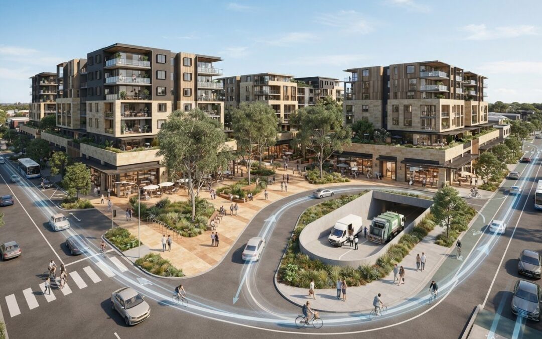
What if the main traffic issue in a mixed-use project isn’t simply the number of extra cars, but how residents, customers, delivery drivers and pedestrians move around one another? A traffic impact assessment for mixed use development needs to examine the site as a connected movement system, rather than treating housing, retail and other uses as separate traffic generators.
Different uses can have different peak periods, while shared access points, servicing areas and parking can affect how people move through the site. A well-scoped assessment considers how trips interact within the development and how site traffic connects with the surrounding road network. It also makes the assumptions behind its demand estimates clear, so design decisions can be based on the proposal rather than broad assumptions about a land-use type.
This guide explains the purpose and scope of a mixed-use TIA, including the land-use assumptions, access arrangements and movement patterns it may assess. You’ll also see how findings can inform decisions about driveways, parking, servicing and pedestrian routes, helping planners and project teams identify potential conflicts while layout options can still be considered.
Key Takeaways
- A traffic impact assessment for mixed use development should connect land-use assumptions with access design and effects on the surrounding network.
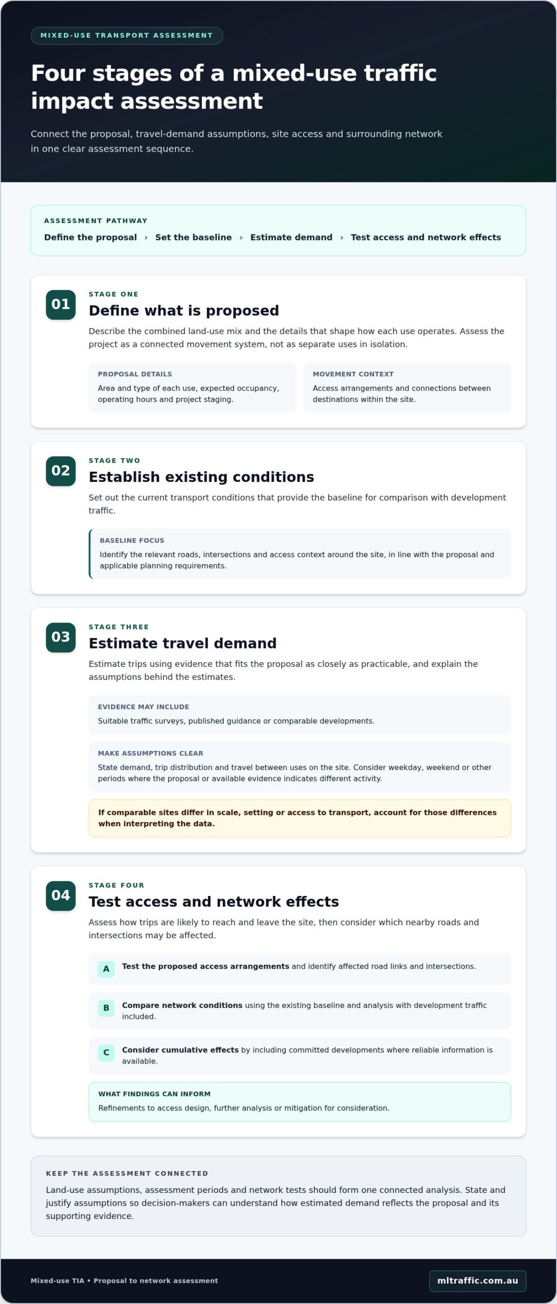
- Use a clear assessment sequence: define the proposal, establish existing conditions, estimate travel demand, then test access and network effects.
- Map pedestrian and cyclist routes alongside vehicle, delivery and waste-collection movements to identify potential conflicts at key locations.
- Coordinate movement routes early, while access and parking layouts can still be shaped around legibility, visibility and directness.
- Present the proposal, assumptions, assessment method and key movement findings clearly to support planning assessment.
What a Traffic Impact Assessment for Mixed-Use Development Needs to Establish
A traffic impact assessment (TIA) is a project-specific review of how a proposed development may affect transport and what responses may be needed. A traffic impact assessment for mixed use development considers the combined effects of its uses, site layout and connections, rather than assessing each use in isolation. Because mixed-use development brings different activities together, its transport assessment needs to consider how people and vehicles move between them and connect with the wider network.
Residential, retail, office and other uses can generate travel at different times and by different modes. A resident walking to a shop within the site may make a different journey from a customer arriving by car or a delivery vehicle accessing a loading area. The assessment distinguishes movement within the site from effects at driveways, nearby intersections and the surrounding transport network.
For a broad overview of TIA considerations, watch this video:
Why the mix of uses changes the traffic assessment
Each use has its own operating pattern. Housing may contribute to commuter travel, while retail activity can attract customers and deliveries at other times. The actual pattern depends on the proposal, including the amount and type of each use, operating hours, access arrangements and connections between destinations.
Shared access and convenient internal routes can influence whether a trip stays within the site or uses the external road network. For example, a person moving between destinations within the development may not need to make the same external vehicle trip as someone visiting only one use. Assess these effects using project details and relevant evidence, rather than assuming that land-use labels alone predict travel behaviour.
What a TIA helps decision-makers understand
A TIA helps explain how the proposal may affect site access and the nearby transport network. Within the site, the review can consider driveway arrangements, vehicle circulation and how different movements interact. Beyond the boundary, it can examine the effect of development traffic on relevant roads and intersections.
Findings can help the project team refine access points, circulation or parking layouts and identify potential mitigation measures for assessment. They give decision-makers a clearer basis for understanding the proposal’s transport effects. The required scope and approval considerations depend on the applicable planning framework and authority, so establish the project requirements for the relevant jurisdiction.
How Mixed-Use Trip Generation and Network Impacts Are Assessed
A sound assessment follows a clear sequence. It confirms what is proposed, establishes existing transport conditions, estimates travel demand, tests site access and evaluates effects on the surrounding network. The method and level of detail should reflect the project and the relevant planning authority’s current requirements.
Setting defensible trip-generation and peak-period assumptions
Start with the proposed land-use mix and the details that influence how each use operates. Inputs may include the area and type of each use, expected occupancy, operating hours, access arrangements and project staging. A residential component, for example, may have a different travel profile from shops or offices. Consider relevant weekday, weekend or other periods where the proposal or available evidence indicates different activity.
Trip estimates can draw on suitable traffic surveys, published guidance or comparable developments. The evidence needs to fit the proposal as closely as practicable. If comparable sites differ in scale, setting or access to transport, account for those differences when interpreting the data. State assumptions about demand, trip distribution and travel between uses on the site, and explain how they affect the assessment.
Assessment assumptions should be stated and justified so decision-makers can understand how the estimated demand reflects the proposal and its supporting evidence.
Testing access, intersections and cumulative effects
Once demand has been estimated, the assessment considers how trips are likely to reach and leave the site. It tests proposed access arrangements and identifies which nearby intersections or road links may be affected. Existing conditions provide the baseline for comparison; the analysis then considers conditions with development traffic included. The scope and method depend on the network, proposal and applicable guidance, rather than one threshold or model being suitable for every project.
Where reliable information is available, committed developments may also be included to understand cumulative effects. This helps distinguish the proposal’s contribution from other expected changes to the network. Findings can inform whether access design needs refinement or whether further analysis or mitigation should be considered.
For a traffic impact assessment for mixed use development, the land-use assumptions, assessment periods and network tests should form one connected analysis. ML Traffic Engineers Australia prepares project-specific traffic assessment services to support planning applications, linking demand assumptions with access and network assessment.
How to Assess Pedestrian Priority Alongside Vehicles, Parking and Servicing
A mixed-use site has several movement systems operating at once. A traffic impact assessment for mixed use development should consider pedestrians and cyclists alongside passenger vehicles, deliveries and waste collection. The aim is to understand how these movements use shared areas and where the proposed layout may create points of interaction, not to assume that every site has the same conflicts.
Mapping pedestrian routes and conflict points
Map likely pedestrian desire lines from site boundaries to building entrances, parking areas, public transport connections and shared destinations. Check whether these routes are direct and legible, and where they cross driveways, parking aisles or loading areas. Review visibility at crossing points and consider whether the layout can provide clear separation between people walking and vehicles where needed.
Account for cyclists and the routes they may use through or past the site. A conflict review can identify locations where a vehicle may reverse, queue or load across a pedestrian route. Test these points against the actual layout and operating arrangements, rather than treating them as automatic findings for every proposal.
| Movement | Route to review | Potential interaction | Design consideration |
|---|---|---|---|
| Pedestrians | Entrances, shared destinations and public transport connections | Crossing driveways or parking aisles | Direct routes, visibility and defined crossing points |
| Cyclists | Site access and internal connections | Interacting with vehicles near access points | Clear, legible movement paths |
| Passenger vehicles | Driveways, circulation aisles and parking | Queuing or manoeuvring across walking routes | Appropriate circulation and visibility |
| Delivery and waste vehicles | Loading and collection areas | Reversing or stopping near pedestrian routes | Functional servicing access and considered route separation |
Coordinating parking, loading and vehicle access
Assess parking as part of the site’s movement network, not as a standalone layout. Review how vehicles enter and leave parking areas, and whether their paths intersect key pedestrian routes. Delivery and waste arrangements should reflect the proposal’s servicing needs. Consider emergency access where it is relevant to the project and applicable planning requirements.
Where applicable, assess car park design against the relevant requirements of AS 2890.1 and AS 2890.2. Confirm the current requirements and how they apply to the project. Reviewing access, parking, loading and walking routes together helps identify layout issues while design options can still be considered.
How to Shape a Mixed-Use Site Around Safer, Clearer Movement
Movement issues are easier to address while the site layout is still being developed. Early coordination between access points, parking, servicing areas and pedestrian routes can reveal conflicts before those elements are fixed. A traffic impact assessment for mixed use development can help compare layout options against the proposal’s movement needs and surrounding network conditions.
Using the assessment to refine access and internal circulation
Review driveway positions and internal circulation alongside pedestrian routes. For example, an access point that appears workable for vehicles may cross a direct route between a residential entrance and a shared destination. The assessment can identify this interaction and help compare project-specific alternatives, such as adjusting the route or revisiting the access arrangement. No single response suits every site.
Where vehicle manoeuvring needs to be tested, swept path diagrams can show how a selected design vehicle moves through driveways, aisles or loading areas. ML Traffic Engineers Pty Ltd uses specialist software such as AutoTURN for swept path analysis. This can inform access and circulation design, but it is not a substitute for a TIA, which considers broader development-related transport effects.
Review car park layouts against applicable design requirements. Relevant guidance may include AS 2890.1 for off-street car parking, where applicable. Check the current standard and project requirements when preparing the design. Related guidance on car park design and swept path analysis can help explain these complementary design considerations.
Balancing pedestrian priority with operational needs
Servicing access, parking demand and pedestrian continuity need to be considered together. A loading area may need to be accessible to delivery vehicles, while a nearby pedestrian route should remain direct and legible. Comparing alternatives can make trade-offs clear, including how each option affects vehicle movement, walking routes, visibility and the use of shared areas.
Assessment criteria may include:
- Legibility: Can people readily understand where to walk, cycle or drive?
- Directness: Do pedestrian routes connect key destinations without unnecessary detours?
- Visibility: Can drivers and pedestrians see one another at relevant crossing points?
- Separation: Can routes be distinguished where vehicle and pedestrian movements interact?
These are considerations for evaluating the proposed layout, not guaranteed outcomes. Their relevance depends on the site and its operating needs. For project-specific support connecting access, parking and vehicle manoeuvres, explore ML Traffic Engineers Pty Ltd’s traffic engineering services.
What a Mixed-Use TIA Should Document Before Planning Assessment
A clear Traffic Impact Assessment (TIA) gives decision-makers a traceable account of the proposal, the evidence considered and the conclusions reached. For a traffic impact assessment for mixed use development, the report should show how the different proposed uses and site movements have been considered together. Its scope should respond to the development and the applicable planning authority’s requirements.
Building a clear, project-specific assessment record
Organise the report so readers can follow the reasoning from proposal through to findings. Each key conclusion should connect to a stated assumption, observed condition or analysis. Identify evidence sources, assessment periods and any limitations that affect how results should be interpreted. This makes the assessment easier to review and its recommendations easier to understand.
Depending on the proposal and assessment scope, documentation may cover:
- The development description, land-use mix, scale and operating assumptions.
- Existing transport conditions and the evidence used to establish the baseline.
- The assessment method, demand assumptions and relevant periods analysed.
- Site access, internal circulation, parking, loading and servicing arrangements.
- Pedestrian and cyclist movement, affected roads or intersections, and key findings.
- Recommended responses, supporting analysis and any limitations.
Include plans and supporting assessments that explain how access and vehicle movements are expected to work. For example, a site layout can show driveways and circulation routes, while swept path diagrams can illustrate vehicle manoeuvres where required. A car parking demand assessment or other supporting analysis may also be relevant to the project. ML Traffic Engineers Pty Ltd provides traffic assessment services to support development applications.
Moving from assessment findings to the next project step
Report findings can inform design coordination and the preparation of application documents. If analysis identifies a potential access or circulation issue, the project team can consider whether a layout change or other response is appropriate. The TIA should describe the issue, the reasoning behind the proposed response and any relevant assumptions. It should not present a project-specific recommendation as a universal solution.
ML Traffic Engineers Pty Ltd brings more than 15 years of traffic engineering and transport planning experience to project-specific TIAs and related assessments, connecting land-use assumptions with access design and network analysis. For a useful assessment record, make sure the report explains how its evidence supports each finding and recommendation.
Discuss your mixed-use development assessment with ML Traffic Engineers Pty Ltd.
Plan Movement as One Connected System
A mixed-use project brings different travel demands into one place. A traffic impact assessment for mixed use development should connect land-use assumptions with site access, internal circulation and effects on the surrounding transport network. Looking at these elements together helps project teams understand how movement may work across the whole site.
Clear assumptions and evidence make the assessment easier to review. Mapping pedestrian and cyclist routes alongside parking, deliveries and servicing can reveal where layout options need closer consideration. Early traffic engineering input can then help inform design decisions and planning documentation, with the assessment scope tailored to the proposal and applicable authority requirements.
ML Traffic Engineers Pty Ltd prepares project-specific Traffic Impact Assessments and related assessments to support development applications. Discuss your mixed-use development assessment and take a considered next step in planning the site’s movement system.
Frequently Asked Questions
What is a traffic impact assessment for a mixed-use development?
A traffic impact assessment for a mixed-use development is a project-specific review of how a proposed combination of uses may affect site access and the surrounding transport network. It considers the development’s travel demand, existing conditions and movement patterns, then documents relevant findings and responses. For example, the assessment may consider how residential, retail and office activity interact, including vehicle access, parking, pedestrian routes and servicing arrangements.
When is a traffic impact assessment required for a mixed-use development?
A traffic impact assessment may be required as part of a development application when the relevant planning authority identifies a need to assess transport effects. Requirements and assessment triggers vary between jurisdictions and projects, so there is no single national threshold to apply to every proposal. The required scope may depend on the development’s scale, land-use mix, access arrangements and potential network effects. Check the current planning framework for the project’s jurisdiction.
What does a mixed-use traffic impact assessment include?
A mixed-use TIA typically describes the proposal, its land-use assumptions, existing transport conditions and assessment method. It may examine estimated travel demand, site access, internal circulation, affected roads or intersections, parking, loading and pedestrian movement. The report should explain its evidence, assumptions, findings and any recommended responses. Its scope is project-specific and should align with the proposal and applicable planning authority requirements.
How does a TIA assess pedestrian priority in a mixed-use development?
A TIA considers pedestrian routes alongside vehicle, cyclist and servicing movements. It can map connections between site boundaries, building entrances, parking, public transport links and shared destinations, then review where routes intersect driveways, parking aisles or loading areas. Visibility, route directness and possible separation are relevant layout considerations. The assessment identifies potential interactions based on the proposed design; it doesn’t assume every site has the same conflicts.
Can a mixed-use development share parking between different uses?
Shared parking may be considered where different uses have parking demand at different times, but its suitability depends on the proposal and applicable planning requirements. An assessment can examine each use’s demand, operating patterns, parking access and how spaces would function for users. For example, retail and residential demand may not peak at the same time, but that should be supported by relevant project evidence rather than assumed. A car parking demand assessment can inform the review.
How are vehicle access and servicing assessed in a mixed-use TIA?
The assessment reviews how vehicles enter, circulate through and leave the site, alongside the effects of access on nearby roads and intersections. It also considers relevant servicing needs, such as delivery and waste-collection routes, and how these interact with parking and pedestrian movement. Swept path analysis can illustrate vehicle manoeuvres at driveways, loading areas or circulation aisles. The assessment scope and design checks should reflect the proposal and applicable requirements.

Disclaimer
The content on www.mltraffic.com.au, including all technical articles, guides, and resources, is provided for general informational and educational purposes only. It is not intended to constitute professional advice in traffic engineering, transportation planning, development approvals, or any other technical or legal field.
While ML Traffic Engineers makes every reasonable effort to ensure the accuracy, completeness, and timeliness of the information published, we do not provide any warranties or representations (express or implied) regarding its reliability, suitability, or availability for any particular purpose. Any reliance you place on the content is strictly at your own risk.
In no event shall ML Traffic Engineers, its directors, employees, authors, or affiliates be liable for any direct, indirect, incidental, special, consequential, or punitive damages (including, without limitation, loss of profits, data, or business opportunities) arising out of or in connection with the use of, or inability to use, any information provided on this website.
The articles and guides on this site are not a substitute for engaging a qualified, registered professional traffic engineer (such as an NPER or RPEQ engineer) to assess your specific project requirements. For tailored advice, compliance assessments, or traffic engineering services, please contact a competent professional.
This disclaimer may be updated from time to time without notice. By accessing or using this website, you agree to be bound by the most current version of this disclaimer.
