
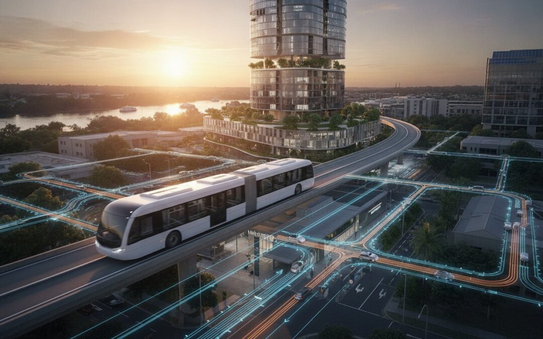
By 2026, the traditional car-centric development model in Brisbane will be obsolete for any project situated within the Brisbane Metro catchment. Developers currently face significant uncertainty regarding the Council’s evolving stance on parking reductions and the technical complexities of managing vehicle access near high-frequency transit stations. You likely understand that the fear of Development Application (DA) delays due to inadequate Traffic Impact Assessments is a legitimate risk to your project timeline and feasibility.
This guide details the specific traffic impact of brisbane metro on new developments, showing you how to leverage this high-capacity infrastructure to achieve Council approval for reduced parking rates. We provide the technical clarity needed to navigate the 2026 regulatory landscape for Transit Oriented Developments (TODs). You will discover how to optimise site access for multi-modal transport and ensure your Traffic Impact Assessment (TIA) meets the rigorous standards required for modern urban infrastructure. We will examine the essential requirements for AS 2890 compliance and the necessity of precise Vehicle Swept Path Analysis in constrained metro-adjacent sites to ensure seamless project delivery.
Key Takeaways
- Understand how the traffic impact of brisbane metro on new developments necessitates a shift toward multi-modal assessments to meet Council’s 2026 infrastructure standards.
- Learn how to justify reduced on-site car parking rates by leveraging proximity to high-frequency Metro stations in your Parking Demand Assessment.
- Identify the critical role of precise Vehicle Swept Path Analysis in ensuring AS 2890 compliance for constrained urban sites near the Cultural Centre and Adelaide Street tunnel.
- Discover strategies for managing complex site access and waste collection requirements without interfering with high-frequency Metro operations.
- Reduce the risk of costly Information Requests (IRs) by engaging senior traffic experts early to address potential access constraints before submitting your DA.
Understanding the Brisbane Metro Network in 2026
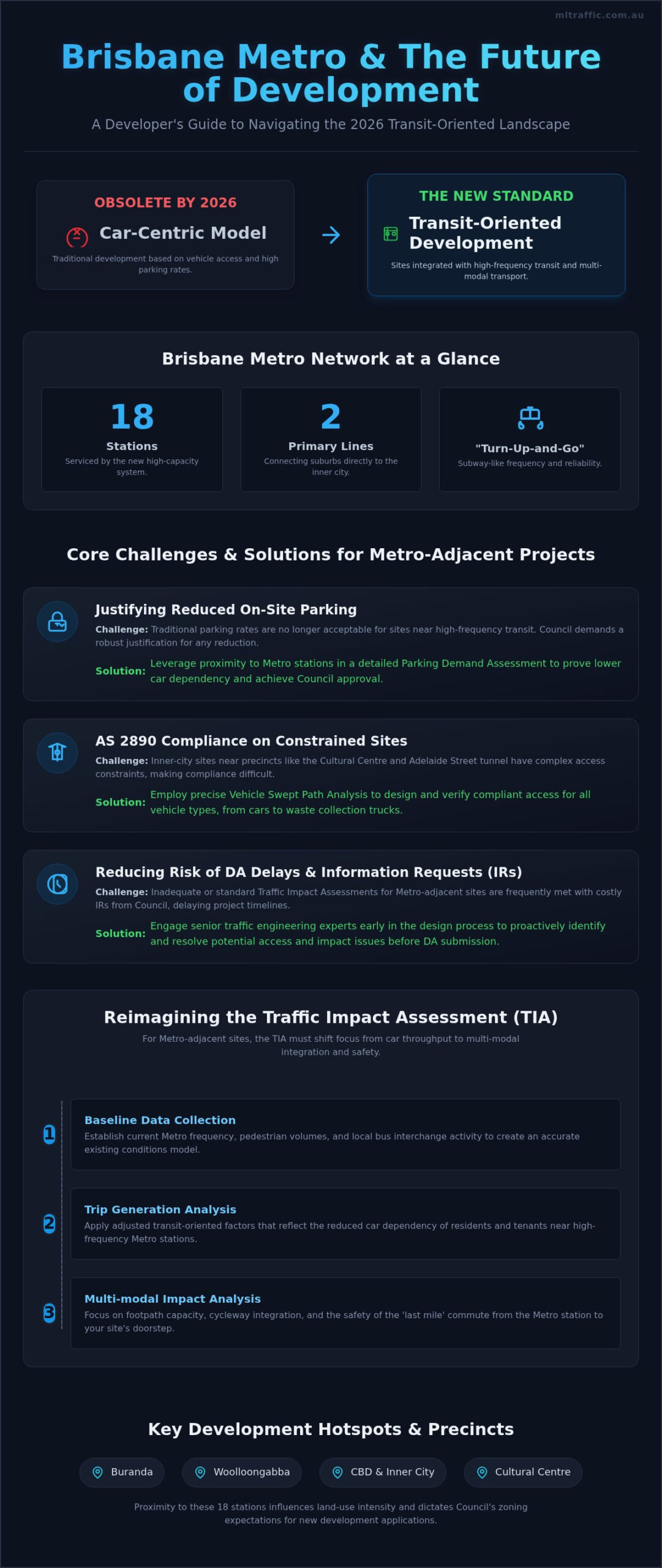
The Brisbane Metro is not merely a bus project; it is a high-capacity, turn-up-and-go transit system designed to function with the frequency and reliability of a subway. By 2026, the network will service 18 stations across two primary lines, linking the suburbs directly to the inner city. The operational heart of this system includes the Adelaide Street tunnel and a revitalised Cultural Centre precinct. This infrastructure aims to remove hundreds of buses from the CBD surface streets, which increases overall commuter capacity and reduces travel times. For the development industry, this infrastructure fundamentally alters the traffic impact of brisbane metro on new developments by redefining what constitutes a well-located site. Traditional metrics of vehicle-based accessibility are being superseded by high-frequency transit proximity and integrated transport links.
Key Station Precincts and Development Hotspots
Strategic precincts such as Buranda, Woolloongabba, and the CBD are the primary focus of this transit-led growth. Proximity to these 18 stations influences land-use intensity and often dictates Council’s zoning expectations for new development applications. When preparing a Traffic Impact Assessment (TIA) Report, you must demonstrate how your project integrates with these high-frequency hubs. A critical component of modern transport planning is the last mile connection. This involves designing sites that facilitate easy transitions from Metro platforms to the final destination via high-quality pedestrian paths and micro-mobility infrastructure. Sites located within the immediate catchment of a Metro station are increasingly viewed by Council as candidates for higher density and significantly reduced car dependency.
Infrastructure Upgrades Affecting Site Access
The physical landscape of Brisbane’s road network has undergone permanent changes to accommodate the Metro. The Victoria Bridge is now a dedicated green bridge, restricted to Metro vehicles, pedestrians, and cyclists. This shift has redistributed private vehicle volumes across other river crossings, altering the baseline data for Intersection Analysis in the inner south. The Adelaide Street tunnel has also modified surface-level traffic flow, creating new challenges for loading dock access and driveway placement. Developers near these works must understand how new tunnel connections affect local road network capacity. Precise planning is required to ensure that site access doesn’t conflict with high-frequency Metro movements, particularly in constrained urban environments where Sight Distance Assessment and Driveway Ramp Grade Assessment are already complex. Managing these technical requirements through expert traffic engineering services is essential for avoiding project delays. Our approach ensures that the same senior expert who initiates your project performs the technical work, providing the accountability needed for complex inner-city developments.
Reimagining Traffic Impact Assessments (TIA) for 2026
The introduction of the Brisbane Metro has fundamentally altered the technical requirements for planning approvals. A standard Traffic Impact Assessment (TIA) Report must now account for a significant modal shift from private vehicles to high-frequency transit services. Brisbane City Council expectations have evolved to prioritise active transport and pedestrian safety over traditional car throughput. For developers, this means the traffic impact of brisbane metro on new developments is measured by how well a site integrates with the network rather than just how many cars it adds to the road. Accurate traffic engineering is the only way to justify performance-based solutions that deviate from prescriptive acceptable outcomes.
The 5-Step TIA Process for Metro-Adjacent Sites
Navigating the 2026 regulatory environment requires a structured approach to data and modelling. We follow a rigorous five-step process to ensure your DA remains on track:
- Step 1: Baseline Data Collection. We establish current Metro frequency, existing pedestrian volumes, and local bus interchange activity.
- Step 2: Trip Generation Analysis. We apply adjusted transit-orientated factors that reflect the reduced car dependency of residents and tenants near Metro stations.
- Step 3: Multi-modal Impact Analysis. This focuses on footpath capacity, cycleway integration, and the safety of the ‘last mile’ commute.
- Step 4: Intersection Analysis. We evaluate how your site access affects major Metro hubs and surrounding signalised intersections.
- Step 5: Mitigation Strategies. We develop technical solutions for any residual traffic impacts, ensuring the project remains compliant with the City Plan.
Shifting from Car-Centric to Multi-Modal Reporting
Traditional trip generation rates often fail to capture the reality of 2026 Metro zones. High-frequency transit makes car ownership a secondary choice for many, meaning old data sets can lead to over-engineered and over-costed parking provision. Modern reporting must incorporate Green Travel Plans into your Traffic Impact Assessment to demonstrate a commitment to sustainable transport. A key metric now is the Pedestrian Level of Service (PLOS), which measures the quality and safety of the walking environment. If your site doesn’t support safe, efficient pedestrian movement to the nearest Metro station, Council is unlikely to support your application. Our senior principals handle this complex technical work directly, ensuring your report stands up to rigorous Council scrutiny. If you’re unsure how these new standards apply to your site, reaching out for an initial expert consultation can prevent costly redesigns later in the process.
Navigating Parking Demand and AS 2890.1 Compliance
Proximity to a high-frequency Metro station is now the primary technical justification for reducing on-site car parking. Brisbane City Council’s ‘car-lite’ policy for Transit Oriented Developments (TODs) encourages developers to deviate from traditional parking rates in favour of sustainable transport. This shift is a direct result of the traffic impact of brisbane metro on new developments, as residents and tenants in these zones increasingly prioritise transit access over private vehicle ownership. A successful Car Parking Demand Assessment must balance this reduction with commercial viability to ensure the project remains attractive to investors while satisfying Council planners.
Justifying Reduced Parking Ratios in TOD Zones
Argue for lower parking rates by using site-specific data rather than generic averages. We utilise latest census data and Metro frequency schedules to prove lower car ownership trends in high-growth precincts. Incorporating car-sharing schemes and high-quality end-of-trip (EOT) facilities further strengthens the case for a ‘performance-based’ parking solution. Successful Brisbane developments in 2026 often feature a 20% to 30% reduction in standard parking supply by demonstrating that the ‘last mile’ of the commute is fully serviced by the Metro network. This approach reduces excavation costs and increases the net lettable area of the site.
Compliance with Australian Standards for Car Park Design
While parking numbers may decrease, the technical rigour of the design must increase. Strict adherence to AS 2890.1 is essential for all new designs to ensure safety and functionality. Developers must ensure that driveway ramp grades, aisle widths, and overhead clearances meet these national standards to avoid costly rectifications during construction. We focus on specific engineering details, including:
- Driveway Ramp Grade Assessment: Ensuring gradients prevent vehicle scraping and maintain safe sight lines.
- Disabled Parking: Precise placement and dimensions to meet statutory accessibility requirements.
- EV Charging Stations: Integrating electric vehicle infrastructure without compromising functional aisle space.
- Smart Parking Systems: Implementing real-time bay monitoring to optimise the use of limited on-site spaces.
Utilising professional car park design services ensures that every square metre of your basement or podium is utilised efficiently. Our senior principals perform the technical work personally, ensuring that your layout is both compliant and cost-effective. This hands-on expertise is vital for navigating the complexities of inner-city sites where space is at a premium and Council scrutiny is high.
Swept Path Analysis and Access Constraints
Inner-city sites near the new Adelaide Street tunnel or the Cultural Centre precinct are physically constrained by narrow frontages and high-capacity transit lanes. The traffic impact of brisbane metro on new developments in these corridors often manifests as restricted vehicle movement and complex access requirements. Brisbane City Council frequently mandates that all vehicles, including waste collection and delivery trucks, enter and exit the property in a forward direction. To satisfy this requirement, developers must provide precise Swept Path Analysis using industry-standard software like AutoTURN. These diagrams prove that the proposed site layout can accommodate the necessary vehicle turns without encroaching on Metro lanes or endangering other road users.
Managing Heavy Vehicle Access in High-Density Areas
Designing functional loading docks within tight Metro precincts requires a deep understanding of AS 2890.2. Commercial vehicle facilities must be tailored to the specific fleet expected on-site, typically ranging from Small Rigid Vehicles (SRVs) to Medium Rigid Vehicles (MRVs). When space is at a premium, every millimetre of the swept path counts. Our technical reports demonstrate exactly how these vehicles navigate the internal ramps and loading bays while maintaining clearance from structural columns. This level of detail is essential for obtaining Council approval for service access in high-density zones where the traffic impact of brisbane metro on new developments has reduced the available road width for private vehicle manoeuvres.
Pedestrian Safety and Sight Distance Requirements
The 18 stations across the Metro network generate significant pedestrian footfall, creating potential conflict points at every driveway. A Sight Distance Assessment is no longer a formality; it’s a critical safety requirement for any development application. Planners require evidence that drivers have clear lines of sight to pedestrians on the footpath before crossing the property boundary. In many cases, we recommend additional safety measures to mitigate risks, such as:
- Convex Mirrors: Strategically placed to eliminate blind spots at the site exit.
- Acoustic and Visual Alarms: Sensors that trigger warnings when a vehicle is approaching the footpath.
- Integrated Pavement Treatment: Using different colours or textures to alert pedestrians to the driveway crossing.
Our senior principals ensure that these safety features are integrated into the initial Car Park Design to prevent costly redesigns during the DA process. If your project involves complex access near a Metro station, you can book a technical review with our experts to identify and resolve these constraints early. This proactive approach ensures your site remains accessible and compliant with the latest 2026 infrastructure standards.
Securing Council Approval with Expert Traffic Engineering
Achieving a successful Development Application (DA) outcome in the 2026 regulatory environment requires more than just meeting minimum standards. Planners now demand a level of technical depth that accounts for the specific traffic impact of brisbane metro on new developments, particularly regarding how private site access interacts with high-frequency transit lanes. Early engagement with a traffic engineer is the most effective way to identify potential ‘deal-breaker’ access issues before they reach the Council’s assessment desk. A robust, data-backed technical report significantly reduces the likelihood of receiving a costly Information Request (IR), which can otherwise stall a project for months.
ML Traffic Engineers Australia provides the authoritative voice needed to navigate these complex transport challenges. We don’t just produce reports; we provide a technical defence of your project’s design. Personnel continuity is a cornerstone of our service, meaning the engineer who designs your traffic scheme is the same expert who defends it during Council negotiations. This consistency ensures that no technical detail is lost in translation and that every performance-based solution is supported by rigorous engineering logic.
The Value of Senior Leadership Involvement
Direct access to senior principals ensures a higher quality of reporting and a level of accountability that larger, more impersonal firms often lack. When negotiating with Council officers, we leverage over 15 years of specialised consultancy experience to advocate for your project’s feasibility. Our ‘no-gatekeepers’ approach means you have a direct line to the experts performing the technical work. This hands-on involvement is vital when justifying deviations from standard parking rates or proposing innovative site access solutions in high-density Metro precincts. We understand the bureaucratic requirements of the Brisbane City Council and the state transport authorities, allowing us to navigate the approval process with precision.
Next Steps for Your Development Application
Moving from the planning phase to a successful submission requires a strategic approach to transport engineering. We recommend starting with a preliminary site access and parking feasibility study to identify any immediate constraints. This initial step informs the broader design and ensures that your project remains commercially viable while meeting 2026 infrastructure expectations. Once the design is finalised, we prepare a comprehensive Traffic Impact Assessment tailored to the specific requirements of your DA submission.
Your project’s success depends on the quality of its technical foundation. If you are developing a site near the new Metro network, the window for optimising your traffic and parking strategy is during the early design stages. Contact ML Traffic Engineers Australia to discuss the traffic impact of brisbane metro on new developments and how we can secure your project’s approval through expert engineering and direct principal involvement.
Optimising Your 2026 Development Strategy
The Brisbane Metro represents a fundamental shift in the city’s transport hierarchy. Success for developers in this new landscape requires a definitive move away from traditional car-centric planning toward integrated, multi-modal solutions. By accurately leveraging the traffic impact of brisbane metro on new developments, you can justify significant parking reductions and maximise the yield of your site. These outcomes are only achievable with a technically rigorous TIA and precise car park design that meets evolving Council expectations. Precision in swept path analysis and strict adherence to AS 2890 standards are now the baseline for any successful inner-city application.
ML Traffic Engineers Australia offers over 15 years of Australian consultancy experience to ensure your project meets these exacting standards. We provide direct principal involvement in every report, ensuring the senior expert who starts your project is the one who performs the technical work and defends it during negotiations. Our proven track record with local Council approvals helps you avoid DA delays and costly Information Requests. Request a Traffic Impact Assessment for your Metro-adjacent project to ensure your site is fully optimised for Brisbane’s high-frequency transit future. We’re ready to help you navigate these complex requirements with confidence.
Frequently Asked Questions
What is a Traffic Impact Assessment (TIA) and why is it needed for projects near the Metro?
A TIA is a technical report that evaluates how a proposed development affects the surrounding transport network. For sites near the Metro, Council requires this assessment to ensure private vehicle movements don’t interfere with high-frequency transit services. The report must demonstrate how the development integrates with the 18-station network and manages the increased pedestrian activity generated by the new infrastructure.
Can I reduce the number of parking spaces in my development if it is near a Metro station?
Yes, proximity to a Metro station is a primary technical justification for reduced parking rates under Council’s ‘car-lite’ objectives for TODs. By submitting a professional Car Parking Demand Assessment, developers can prove that the traffic impact of brisbane metro on new developments reduces the need for private vehicle storage. This often leads to significant cost savings in basement excavation and increases the project’s net lettable area.
How does the Brisbane Metro affect the trip generation rates for my residential project?
Trip generation rates are typically lower for residential projects within Metro catchments due to higher transit mode shares. We use site-specific data and transit-oriented development factors to adjust these rates in your TIA. This reflects the reality that residents near high-frequency hubs are less likely to perform peak-hour vehicle trips compared to those living in car-dependent suburbs.
What is Swept Path Analysis and is it mandatory for Council approval?
Swept Path Analysis is a computer-simulated diagram proving that specific vehicles can safely navigate a site’s access points and internal aisles. It is mandatory for most Brisbane development applications, especially in constrained inner-city zones. Council planners require these diagrams to ensure waste collection and delivery vehicles can enter and exit in a forward direction without disrupting Metro traffic flow.
Will the Metro construction impact my site access during the development phase?
Permanent changes to the road network, such as the Adelaide Street tunnel and Victoria Bridge conversion, can permanently alter site access. Developers must account for these changes in their initial planning to avoid conflicts with Metro operations. We conduct detailed site assessments to identify any physical constraints that might affect your project’s driveway placement or loading dock functionality during and after the 2026 operational rollout.
How do I ensure my car park design complies with AS 2890.1?
Compliance is achieved by strictly adhering to the geometric requirements for ramp grades, aisle widths, and bay dimensions specified in AS 2890.1. Our senior principals perform the technical design work directly to ensure every layout meets these national standards. This meticulous approach prevents costly construction errors and ensures your car park is functional for all user groups, including requirements for disabled parking and electric vehicle charging.
Does proximity to the Metro change the requirements for bicycle parking and end-of-trip facilities?
Council often mandates higher provision for bicycle parking and end-of-trip (EOT) facilities for developments near major transit hubs. These facilities are essential for supporting the ‘last mile’ of the commute and are frequently used as a technical trade-off for reduced car parking. A compliant design must include secure storage, lockers, and change rooms that meet the specific standards outlined in the Brisbane City Plan.
How long does it take to prepare a professional traffic impact report for a DA?
Preparation times vary depending on project complexity, but a standard Traffic Impact Assessment Report typically takes two to four weeks. This timeframe includes baseline data collection, trip modelling, and drafting the technical report. Engaging an expert early in the design phase ensures that any potential access constraints are resolved before the final report is submitted with your development application.

Disclaimer
The content on www.mltraffic.com.au, including all technical articles, guides, and resources, is provided for general informational and educational purposes only. It is not intended to constitute professional advice in traffic engineering, transportation planning, development approvals, or any other technical or legal field.
While ML Traffic Engineers makes every reasonable effort to ensure the accuracy, completeness, and timeliness of the information published, we do not provide any warranties or representations (express or implied) regarding its reliability, suitability, or availability for any particular purpose. Any reliance you place on the content is strictly at your own risk.
In no event shall ML Traffic Engineers, its directors, employees, authors, or affiliates be liable for any direct, indirect, incidental, special, consequential, or punitive damages (including, without limitation, loss of profits, data, or business opportunities) arising out of or in connection with the use of, or inability to use, any information provided on this website.
The articles and guides on this site are not a substitute for engaging a qualified, registered professional traffic engineer (such as an NPER or RPEQ engineer) to assess your specific project requirements. For tailored advice, compliance assessments, or traffic engineering services, please contact a competent professional.
This disclaimer may be updated from time to time without notice. By accessing or using this website, you agree to be bound by the most current version of this disclaimer.
