
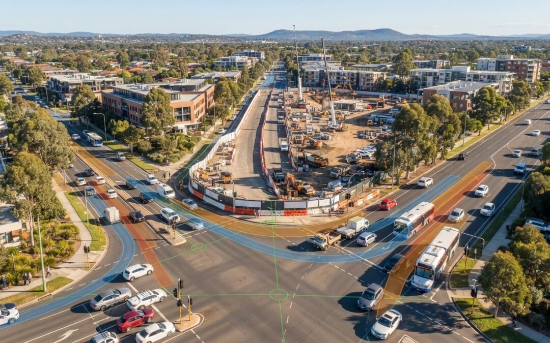
Securing council consent to shut down an urban thoroughfare has very little to do with simply plotting an alternative detour on a map. When road authorities evaluate the traffic impact of closing a public road for development, their focus centres entirely on network equilibrium and safety preservation. If a proposed closure pushes an adjacent corridor beyond capacity, the application stalls immediately.
Managing the distinction between a statutory road discontinuance and a temporary closure permit is complex. Unexpected council pushback over displaced bus routes, emergency access, and heavy vehicle swept paths can freeze your planning timeline for months. You shouldn’t have to face protracted delays or outright refusal caused by unaddressed network friction. This guide explains how public closures reshape surrounding traffic networks and details the technical documentation councils demand. We examine the capacity modelling, intersection assessments, and safety documentation needed to prove network equilibrium and keep your project moving forward.
Key Takeaways
- Distinguish between temporary works possession and statutory road discontinuance to determine the specific engineering assessments required to evaluate the traffic impact of closing a public road for development.
- Establish accurate baseline traffic volumes using peak-hour counts to prove redirected traffic will not exceed surrounding corridor capacity or cause intersection failure.
- Verify detour route geometry with vehicle swept path analysis to ensure unhindered passage for emergency vehicles, buses, and heavy construction traffic.
- Implement staged closure schedules and comprehensive traffic guidance schemes to mitigate network friction and resolve council safety concerns proactively.
- Prepare a defensible Traffic Impact Assessment (TIA) report supported by empirical modelling to satisfy road authority scrutiny and prevent project delays.
Understanding Road Closures in Development: Temporary Possession vs Permanent Discontinuance
Modifying public road access fundamentally shifts network equilibrium. Closing a corridor redistributes vehicle trips across neighbouring local streets, compromises direct access to adjoining properties, and alters baseline safety parameters. Developers often treat all road occupations identically, but statutory road authorities draw an uncompromising line between temporary physical occupations and permanent legal closures.
Rigorous justification is mandatory whether site possession spans three hours for a plant lift or extinguishes access permanently. To understand how changes to the public road network affect driver distribution and travel times, watch this visual analysis of network flow dynamics:
Every road authority evaluates the overall traffic impact of closing a public road for development against the network’s capacity to absorb diverted vehicles safely. Determining whether your project requires short-term traffic permits or a complex legal discontinuance governs the exact engineering pathway required.
Temporary Road Closures for Construction Logistics
A temporary road closure grants short-term possession of the road reserve under local council permits and state road authority consent to execute high-risk construction activities within strict operational timeframes. These short occupations facilitate mobile crane mobilisation, concrete boom pump setups, heavy structural deliveries, and deep utility service connections. Staged closures minimise broader network disruption by confining high-impact occupations to off-peak periods or night shifts. Approval requires a detailed Traffic Guidance Scheme (TGS) alongside a comprehensive Traffic Impact Assessment (TIA) Report to establish detour routes and pedestrian protection governed by established road traffic control standards.
Permanent Road Discontinuance and Road Closures
Permanent road discontinuance legally extinguishes the public right-of-way over a road, laneway, or unused road reserve, allowing the underlying land to be amalgamated into a private development title. Municipal councils and transport departments mandate exhaustive assessments to prove that the road corridor possesses no ongoing transport utility or strategic network function. Developers must satisfy complex statutory requirements, including public gazettals, utility asset relocations, and community consultation, backed by empirical modelling confirming that the traffic impact of closing a public road for development will not compromise surrounding network safety.
- Temporary closure: Operates under short-term council permits, manages construction logistics, and relies on active traffic control.
- Permanent discontinuance: Extinguishes public rights-of-way, alters title boundaries, and requires statutory council resolutions.
Key Traffic Impacts Assessed When Closing a Public Road
Quantifying network disruption requires evaluating operational performance, accessibility, and local safety. When determining the traffic impact of closing a public road for development, municipal councils and state road authorities evaluate several interdependent engineering metrics. Simply showing an alternate route on street maps won’t satisfy statutory scrutiny.
Closing a link redistributes vehicular trips onto adjacent local collector streets that lack the geometric width or structural pavement capacity to absorb excess load. While theoretical transport studies show network modifications can occasionally alleviate congestion by removing conflicting turning phases, urban closures routinely trigger localised queuing and access failures.
Network Capacity and Intersection Performance Shifts
Diverted volumes reduce available reserve capacity at neighbouring intersections. Traffic engineers assess changes to degree of saturation (DOS), 95th percentile queue lengths, and average vehicle delay. Critical intersections must maintain an acceptable Level of Service (LoS), typically defined as LoS D or better under peak operating periods. If redistributed traffic elevates local residential street volumes above environmental capacity targets (often 2,000 to 3,000 vehicles per day), authorities will reject the closure without engineered mitigation.
Vulnerable Road User Safety and Active Transport Disruption
Road closures frequently sever established footpaths, shared pedestrian zones, and cycle corridors. Detour routes must maintain accessibility and provide continuous pathways compliant with disability access standards. Displaced pedestrians will not take extensive detours; unmanaged closures generate dangerous mid-block jaywalking across active construction access points. Temporary crossings require verifiable sight distance lines and physical barriers to shield pedestrians from heavy construction vehicles.
Loss of Kerbside Use, Parking, and Service Access
Shutting down a street alters kerbside allocations, leading to distinct operational issues:
- Commercial and residential parking loss: The immediate elimination of on-street spaces increases cruising times and displaces parking into neighbouring streets.
- Service and waste access: Heavy waste collection vehicles require compliant turning heads; terminating a road without adequate turnaround space forces hazardous long-distance reversing.
- Emergency response maintenance: Primary response corridors require continuous clear carriageway widths, typically an unobstructed width of at least 4.0 metres.
- Public transport delays: Displaced bus routes lead to cancelled stops, altered timetables, and passenger interchange failures.
Developers facing contentious council feedback can engage senior transport planners to conduct a comprehensive Intersection Analysis before lodging closure documentation.
Engineering Methodologies: Modelling Traffic Network Disruption
Subjective claims regarding traffic flow carry zero weight with statutory authorities. Accurately demonstrating the traffic impact of closing a public road for development demands empirical baseline data and calibrated computational analysis. Senior transport engineers apply standardised methodologies to evaluate whether surrounding infrastructure can absorb redirected volumes safely.
Baseline Traffic Surveys and Network Assignment
Analytical modelling begins by establishing existing traffic conditions across the affected precinct. Engineers undertake comprehensive surveys to document peak-hour turning movements, 7-day automated traffic counts, vehicle classification breakdowns, and active transport numbers. Origin-destination (O-D) paths determine how motorists will logically divert when access ceases. This reassignment accounts for seasonal fluctuations, school zones, and neighbouring approved developments to ensure the baseline network model reflects peak operational conditions accurately.
Intersection Analysis Using SIDRA Software
Engineers evaluate network resilience using SIDRA Intersection, the standard analytical tool accepted by Australian road authorities and municipal councils. The software tests baseline intersection conditions against post-closure redistribution scenarios. Analysis focuses on three primary performance indicators:
- Degree of Saturation (DOS): Gauges operational capacity, requiring critical movements to remain below acceptable operational thresholds (typically under 0.90 for signalised intersections).
- 95th Percentile Queue Lengths: Identifies spatial queuing risks to ensure diverted traffic doesn’t spill back through upstream intersections.
- Average Delay and Level of Service (LoS): Measures control delay per vehicle, ensuring overall intersection delay does not deteriorate past council tolerances.
Vehicle Swept Path Analysis Along Detour Routes
While standard passenger vehicles adapt easily to detours, diverted heavy vehicles introduce severe geometric challenges. Narrow residential streets, tight kerb radii, and on-street parking along alternate routes create immediate conflict points for heavy rigid vehicles, commuter buses, and emergency response appliances.
Engineers conduct a rigorous computer-simulated Vehicle Swept Path Analysis to assess turning movements across every proposed diversion corridor. These simulations verify wheel track paths, body overhang envelopes, and lateral clearances against existing kerbs, poles, and parked cars. Demonstrating that heavy vehicles can navigate detour alignments without crossing centreline markings or mounting kerbs eliminates a major hurdle during council review.
Precise empirical modelling proves to approval authorities that your detour network functions practically and safely under full peak load.
Mitigation Strategies: How Developers Secure Council Approval
Approval authorities do not grant road closures based on optimistic assumptions. When developers present strategies to counter the traffic impact of closing a public road for development, councils demand fully engineered, evidence-based mitigations. A successful submission pairs empirical traffic modelling with practical, staged operational controls that preserve network equilibrium.
Developing Clear Detour and Signage Strategies
Diverting vehicles successfully requires rerouting traffic along corridors of equal or higher functional hierarchy. Pushing arterial movements onto local collector roads causes severe community backlash and immediate council refusal. Transport planners design a comprehensive Traffic Guidance Scheme (TGS) specifying:
- Advance warning signage positioned well ahead of critical decision junctions.
- Variable Message Signs (VMS) alerting motorists weeks before works commence.
- Unambiguous directional wayfinding to stop heavy vehicles from infiltrating narrow residential roads.
Signal Timing Adjustments and Intersection Upgrades
Surrounding intersections often require temporary operational modifications to absorb diverted trips. Liaising with road authorities allows engineers to adjust signal phase splits and green times dynamically via traffic management centres. In constrained locations, developers may need temporary turning bans, extended slip lanes, or modified pavement markings to prevent queue spillback across through-lanes.
Formal Stakeholder and Agency Engagement
Overcoming objections requires consulting regulatory stakeholders before lodging development applications. Police, fire, and ambulance agencies require verified minimum corridor widths and clear travel paths. Public transport operators must confirm that relocated bus routes and stops maintain passenger timetable viability. Engaging surrounding landholders early resolves commercial access concerns before public exhibition periods begin.
Every analytical finding and mitigation plan must be consolidated into a rigorous Traffic Impact Assessment (TIA) Report that directly addresses statutory expectations. To ensure your project meets all regulatory benchmarks without costly delays, contact ML Traffic Engineers Australia to consult directly with our senior principals.
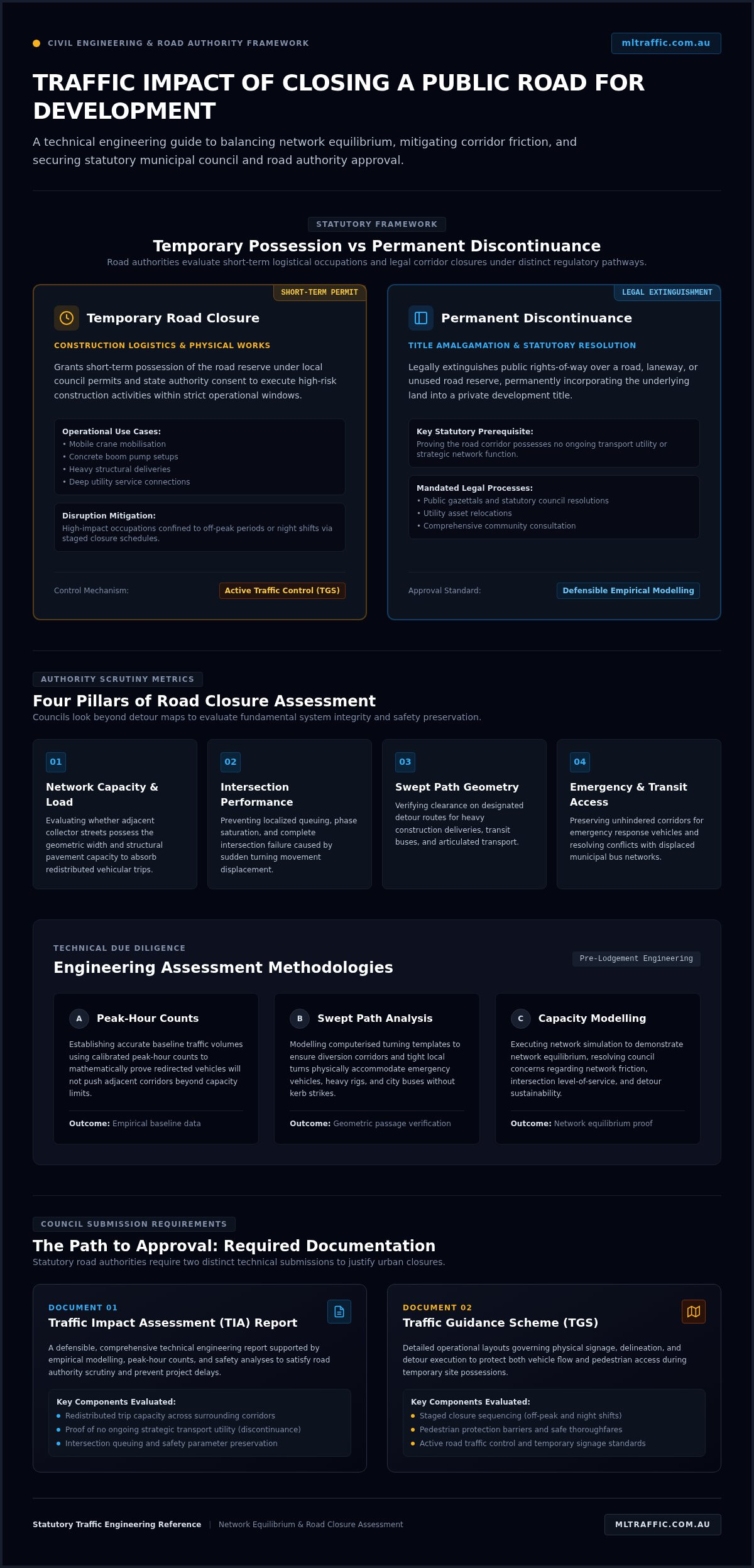
The Path to Approval: Traffic Engineering Documentation Required
Securing council consent for temporary road occupations or permanent road discontinuances hinges on the submission of defensible technical documentation. Assessment officers won’t approve road network modifications based on verbal assurances or generic checklists. A formal submission must link statutory planning objectives with empirical network safety and operational performance, demonstrating that the traffic impact of closing a public road for development remains within acceptable thresholds.
Traffic Impact Assessments for Road Closures
A comprehensive Traffic Impact Assessment (TIA) Report represents the primary technical document required by planning authorities. This report details baseline traffic volumes, trip reassignment modelling, and forecasted post-closure intersection operations. Fully aligned with Austroads guidelines and relevant Australian Standards (including AS 2890), the TIA evaluates sight lines, network capacity, and multi-modal safety. It gives council assessment officers the transparent technical justification needed to recommend formal development approval.
Traffic Guidance Schemes and Management Documentation
Complementing the strategic TIA, a Traffic Guidance Scheme (TGS) governs the operational execution of works within the road corridor. These detailed engineering drawings specify:
- Advance warning signage locations, regulatory speed controls, and variable message board placements.
- Dedicated pedestrian detour corridors with positive physical protection barriers.
- Heavy construction plant access gates and vehicle marshalling zones.
- Delineation hardware, lane taper lengths, and temporary line-marking alterations.
This technical package ensures contractors maintain statutory compliance while occupying public rights-of-way during active construction phases.
Engaging Expert Traffic Engineers Early
Engaging a qualified traffic consultant during the feasibility phase prevents redesigns, planning refusals, and protracted delays. Early engineering input uncovers critical network constraints before architectural layouts, boundary amalgamations, or construction logistics plans become locked in.
With over 15 years of transport planning experience nationwide, ML Traffic Engineers Australia provides direct senior principal oversight across every modelling and reporting phase. Developers can resolve complex network challenges and satisfy road authority scrutiny by accessing our comprehensive traffic engineering services before lodging formal development applications.
Achieving Council Consent for Development Road Closures
Proving network equilibrium remains the deciding factor in road closure approvals. Evaluating the traffic impact of closing a public road for development demands a clear technical distinction between temporary site possession and statutory discontinuance. Backing your application with calibrated intersection modelling and swept path verification eliminates subjective council objections while protecting surrounding network capacity.
Statutory road authority requirements shouldn’t derail your delivery timeline. With over 15 years delivering compliant traffic reports for council development applications across Australia, ML Traffic Engineers Australia provides direct access to senior principals who conduct the technical engineering assessments. Every assessment maintains rigorous compliance with Austroads guidelines and Australian Standards AS 2890, giving consent authorities complete confidence in your submission. Speak with our senior traffic engineers to resolve your network challenges and secure timely project approval.
Frequently Asked Questions
What is the difference between a temporary road closure and a road discontinuance?
A temporary road closure grants short-term possession of a public road reserve for specific construction operations under local permits and traffic management plans. Once works conclude, full public access resumes. A road discontinuance is a permanent statutory process that legally extinguishes the public right-of-way. The road reserve ceases to be public infrastructure and is typically sold or amalgamated into adjoining private titles for site development.
Can a local council refuse a road closure application for private development?
Yes, local councils possess statutory authority to refuse closure applications if they compromise network efficiency, safety, or community access. If an engineering study shows that the traffic impact of closing a public road for development causes unacceptable intersection queuing, removes essential parking without offsets, or creates hazardous detours, council will reject the proposal. Clear technical documentation demonstrating network equilibrium is essential to prevent outright refusal.
How do traffic engineers assess the traffic impact of closing a road?
Traffic engineers collect baseline volume and turning-movement counts during peak periods to evaluate network performance before any changes occur. Using analytical modelling tools like SIDRA Intersection, they simulate how diverted trips reassign across neighbouring streets. The assessment evaluates degree of saturation, queue lengths, average delays, and active transport safety to prove surrounding corridors can absorb redistributed vehicles without network failure.
What happens to emergency vehicle access when a public road is closed?
Emergency services maintain strict access requirements that developers must satisfy before receiving closure approval. Road closures cannot isolate properties or create unmanageable response delays. Detour corridors or maintained carriageways must provide unobstructed lane widths, typically at least 4.0 metres, with adequate vertical clearances. Engineering submissions must demonstrate that fire appliances, ambulances, and police vehicles can safely negotiate the detour network at all times.
Is a Vehicle Swept Path Analysis required for detour routes during closures?
Yes, road authorities routinely demand a Vehicle Swept Path Analysis when detours divert traffic onto narrower local roads. Computer simulations verify that heavy rigid vehicles, commuter buses, waste trucks, and emergency services can safely negotiate intersections along the detour. This analysis identifies tight kerb radii, potential conflict points, and pinch points where large vehicles might mount footpaths or strike road infrastructure.
How long does it typically take to obtain approval for a road closure?
Approval timelines vary significantly depending on the nature of the application. Simple temporary closures for weekend construction tasks may take between four to eight weeks for council and road authority sign-off. Conversely, statutory road discontinuances require formal engineering reviews, utility authority referrals, public advertising, and council resolutions. This permanent legal process routinely requires six to twelve months or longer to finalise.
Who is responsible for notifying affected residents about a proposed road closure?
The applicant or developer holds primary responsibility for resident and business notifications, in strict accordance with council permit conditions. Notifications usually require direct letterbox drops, on-site variable message signs, and public notices published well ahead of the start date. For permanent closures, councils handle formal statutory advertising and public gazettals, though developers must fund the process and supply the necessary traffic impact documentation.

Disclaimer
The content on www.mltraffic.com.au, including all technical articles, guides, and resources, is provided for general informational and educational purposes only. It is not intended to constitute professional advice in traffic engineering, transportation planning, development approvals, or any other technical or legal field.
While ML Traffic Engineers makes every reasonable effort to ensure the accuracy, completeness, and timeliness of the information published, we do not provide any warranties or representations (express or implied) regarding its reliability, suitability, or availability for any particular purpose. Any reliance you place on the content is strictly at your own risk.
In no event shall ML Traffic Engineers, its directors, employees, authors, or affiliates be liable for any direct, indirect, incidental, special, consequential, or punitive damages (including, without limitation, loss of profits, data, or business opportunities) arising out of or in connection with the use of, or inability to use, any information provided on this website.
The articles and guides on this site are not a substitute for engaging a qualified, registered professional traffic engineer (such as an NPER or RPEQ engineer) to assess your specific project requirements. For tailored advice, compliance assessments, or traffic engineering services, please contact a competent professional.
This disclaimer may be updated from time to time without notice. By accessing or using this website, you agree to be bound by the most current version of this disclaimer.
