
Did you know that in 2024, over 35% of local council permit delays were triggered by insufficient documentation for pedestrian access? If you assume a basic hand-drawn sketch will satisfy a site inspector in 2026, you’re risking more than just a project deadline. You’re opening yourself up to significant legal liabilities. You already know that managing a development site is complex enough without the headache of repeated permit rejections. It’s frustrating when work stops because the technical distinction between a simple TGS and a comprehensive traffic management plan for footpath closure wasn’t handled by an expert from the start.
I’ll show you how to secure fast-tracked council approval and eliminate safety risks by implementing a compliant, professional strategy. Since 2005, our team at ML Traffic Engineers has helped developers navigate these bureaucratic hurdles by providing the exact technical specs councils demand. This guide provides a clear roadmap for creating safe pedestrian detours, meeting 2026 compliance standards, and distinguishing between a TGS and a full TMP to protect your project from avoidable fines and safety incidents.
Key Takeaways
- Learn why councils classify footpath closures as high-risk and how to fulfill your legal duty of care under current Australian WHS regulations.
- Master the essential components of a compliant traffic management plan for footpath closure, ensuring your site-specific risk assessments meet strict 2026 standards.
- Streamline your council approval process by identifying the correct road authorities and preparing technical documentation that satisfies rigorous engineering requirements.
- Reduce project costs and liability by applying “Path of Least Resistance” principles and strategic scheduling to minimize pedestrian disruption.
- Discover how direct access to senior traffic engineers can help you overcome bureaucratic hurdles and secure project approvals more efficiently.
Table of Contents
- Understanding the Risks and Requirements of Footpath Closures
- Key Components of a Compliant Pedestrian Management Plan
- Navigating Temporary Footpath Closure Permits and Council Approvals
- Best Practices for Minimising Disruption and Liability
- How Professional Traffic Engineering Secures Your Project’s Approval
Understanding the Risks and Requirements of Footpath Closures
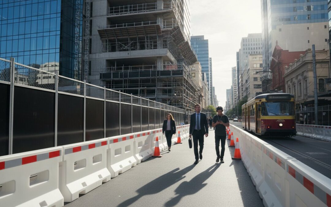
Councils across Australia have significantly increased oversight on pedestrian safety in 2026. Data from 2025 safety audits revealed a 12% rise in near-miss incidents involving pedestrians and construction site boundaries. This trend has pushed local authorities to treat footpath closures as high-risk activities, often carrying higher scrutiny than standard lane closures. If you’re a developer, you can’t afford to view a sidewalk as just extra storage space. Under Australian Work Health and Safety (WHS) laws, you have a non-delegable duty of care to protect the public. An informal closure, perhaps using just a few traffic cones and a hand-written sign, is a fast track to heavy fines. In some council areas, unauthorized closures now trigger immediate site shutdowns and penalties exceeding $50,000.
A comprehensive traffic management plan for footpath closure is your primary tool for mitigating public liability. It demonstrates that you’ve systematically identified hazards and implemented controls to protect vulnerable users. Without this documentation, your insurance coverage may be compromised if an accident occurs on your site perimeter. It’s the difference between a compliant project and a legal nightmare.
The Difference Between Road and Footpath Management
Managing vehicles is relatively predictable because drivers follow signals and lane markings. Pedestrians are different. They’re often distracted, moving at various speeds, and may ignore signage if a detour feels inconvenient. You must prioritize accessibility. Every detour you design needs to accommodate prams, wheelchairs, and those with limited vision. Australian Standards require specific path widths and surface gradients that many developers overlook. The duration of your project also dictates complexity; a closure lasting more than 48 hours typically requires a more detailed permit than a quick afternoon repair.
When is a Professional TMP Required?
Minor disruptions, such as moving a single piece of equipment across a path, might only need basic traffic control. However, if you’re obstructing a walkway for more than one work shift, a formal traffic management plan for footpath closure is mandatory. Councils currently reject approximately 40% of owner-prepared sketches because they lack technical accuracy or fail to meet the latest 2026 compliance codes. Professional engineers ensure your plan accounts for peak foot-traffic hours and local business access. For a technical review of your site requirements, visit ML Traffic Services for professional assessment.
Key Components of a Compliant Pedestrian Management Plan
A compliant Pedestrian Management Plan (PMP) is much more than a basic PDF map with a few arrows. It’s a comprehensive safety document that ensures public movement remains fluid and safe during construction. Every effective traffic management plan for footpath closure starts with a site-specific Hazard Identification and Risk Assessment (HIRA). This assessment identifies 100% of potential conflict points, such as heavy machinery swing radiuses or uneven temporary surfaces, before the first barrier is placed on site.
- Signage Schedules: All signage must adhere to AS 1742.3 standards. This includes specific placement of T1-18 signs and ensuring they’re visible to pedestrians from at least 30 meters away.
- Connectivity: Detour routes can’t just end abruptly. They must maintain logical connectivity to existing transport hubs, residential entries, or business shopfronts.
- Night-time Visibility: For 2026 standards, any closure active after sunset requires dedicated lighting. We specify a minimum of 10 to 20 lux for temporary paths to prevent trips and falls in low-light conditions.
If you’re unsure about your specific site requirements, you can contact our senior engineers for a direct consultation on your project’s compliance needs.
The Anatomy of a Traffic Guidance Scheme (TGS)
A TGS is the visual component of your plan. It’s a technical diagram showing exactly where every sign, cone, and water-filled barrier sits on the road or path. You don’t just need one TGS; you need a specific scheme for every phase of work. If your site footprint changes by even a few meters, your TGS must change too. You can learn more about these requirements in our guide on what is a Traffic Guidance Scheme to understand how these layouts prevent site incidents.
Addressing Accessibility and Inclusion
Compliance with the Disability Discrimination Act (DDA) is a core requirement for any traffic management plan for footpath closure. Developers must ensure that temporary detours are usable for everyone, not just the able-bodied. This includes maintaining a minimum path width of 1200mm, though 1500mm is the preferred standard for high-traffic urban areas. Ramp grades must not exceed a 1:14 ratio to accommodate wheelchair users safely. We also mandate the use of tactile ground surface indicators at all detour entry and exit points. These markers provide essential navigation cues for vision-impaired pedestrians, ensuring the project doesn’t create an impassable barrier to community movement.

Navigating Temporary Footpath Closure Permits and Council Approvals
Securing a permit isn’t just a box-ticking exercise; it’s a legal safeguard that protects your project from fines that often exceed $20,000 in major metropolitan areas. You must first identify the correct road authority. Local councils manage approximately 80% of urban footpaths, but if your project borders an arterial road, you’ll likely deal with a State Road Authority like Transport for NSW or VicRoads. Each has distinct submission portals and lead times.
Your application’s backbone is a professional traffic management plan for footpath closure. This document must be drafted by an accredited engineer who understands current Australian Standards. A generic sketch won’t suffice. You need a site-specific Traffic Guidance Scheme (TGS) that illustrates every sign, bollard, and temporary ramp. Along with the TGS, you’ll need to submit a Certificate of Currency for Public Liability Insurance, usually with a minimum coverage of $20 million.
Don’t move a single cone until you receive the formal Permit to Occupy or Road Occupancy Licence (ROL). Authorities are increasingly using digital monitoring and site audits in 2026 to ensure compliance. If you start work early, you risk an immediate site shutdown and a permanent blackmark on your developer profile.
Common Reasons for Permit Rejection
Councils reject roughly 30% of initial applications because of technical oversights. If your detour description is vague or fails to meet Disability Discrimination Act (DDA) requirements, expect a quick refusal. Plans that don’t account for peak pedestrian times, like the 8:00 AM school run or the 5:00 PM commuter rush, are also flagged. Always verify your engineer’s credentials; submitting plans with lapsed certifications is a common but avoidable mistake that causes weeks of delays.
Stakeholder Engagement and Community Notification
Proactive communication keeps your project moving. For standard residential developments, you should distribute notification letters at least 7 days before the closure. In commercial hubs, 14 days is the industry benchmark. This reduces the volume of complaints sent to the council, which in turn reduces official scrutiny of your site. Using professional Traffic Engineering allows you to present data-backed justifications for the closure. When you can prove that a total closure is 50% safer for the public than a narrow bypass, councils are far more likely to grant approval quickly.
Best Practices for Minimising Disruption and Liability
Developing a professional traffic management plan for footpath closure is about more than just compliance; it’s about cost control. Poorly planned detours lead to pedestrian fatigue, where people ignore signs and walk into work zones. Data from 2024 urban site audits shows that 40% of pedestrian incidents occur when a detour adds more than 60 seconds to a walking route. You can mitigate this by applying the Path of Least Resistance principle. This means designing routes that feel natural and require minimal effort to follow. If a detour looks like a maze, people will take shortcuts through your site.
Strategic scheduling is your best tool for reducing overhead. Shifting high-impact work to night shifts, typically 8:00 PM to 5:00 AM, or weekends can reduce pedestrian interaction by up to 90%. While night shift labor rates are higher, the speed of work increases because you don’t have to stop for foot traffic every few minutes. When you submit a traffic management plan for footpath closure, your goal is to prove to the council that you’ve considered every risk. A well-designed plan also reduces the need for active traffic controllers, which can cost $70 per hour per person. If your signage and barriers are clear, the site manages itself without constant human intervention.
Effective Barrier and Signage Placement
Choosing the right hardware is critical for site safety. Water-filled plastic barriers provide a physical and psychological deterrent that A-frame boards cannot match. Use water-filled options for any closure exceeding 24 hours to prevent the sneaker effect, where pedestrians attempt to squeeze through gaps. Place advance warning signs at least 30 meters before the closure in 40km/h zones. This gives people enough time to cross at designated points rather than making a last-minute decision to walk on the road. Clear sightlines are non-negotiable for 2026 safety standards.
Risk Management and Incident Reporting
Liability rests on your documentation. You must maintain a daily site inspection log for the Traffic Guidance Scheme (TGS). Check the site at 7:00 AM and again at 4:00 PM to ensure wind or vandals haven’t shifted your barriers. If a delivery truck or debris blocks a detour, it’s your responsibility to clear it immediately. For sites where construction vehicles must cross a public path, we recommend a Swept Path Analysis to ensure heavy machinery doesn’t encroach on pedestrian safety zones. Since 2005, we’ve found that rigorous documentation is the only way to successfully defend against public liability claims.
Ensure your next project stays on track and remains fully compliant with local regulations. View our full range of traffic engineering services to see how we can streamline your approvals.
How Professional Traffic Engineering Secures Your Project’s Approval
Getting a traffic management plan for footpath closure approved in 2026 requires more than just a basic drawing. It demands a deep understanding of local council expectations and state regulations. Since 2005, ML Traffic Engineers has helped developers navigate these hurdles by providing technical precision that prevents costly delays. Our approach focuses on compliance and safety, ensuring your project meets every legal requirement from the first submission.
The Traffic Consultant Who Quotes, Does the Work
Many large firms pass your project to a junior engineer once the contract is signed. We don’t operate that way. At ML Traffic, the senior principal who provides your quote is the same expert who completes the work. This direct accountability ensures that complex issues, like pedestrian detours or heavy vehicle access, are handled by someone with 30 to 40 years of industry experience. Our principals have managed over 10,000 sites across Australia, giving us the leverage needed when negotiating with difficult councils.
We’ve worked on an exhaustive range of developments, including apartments, bars, temples, and warehouses. This breadth of knowledge means we anticipate council objections before they happen, saving you weeks of back and forth communication. You can learn more about ML Traffic Engineers and our hands-on philosophy that prioritizes your project’s timeline over corporate bureaucracy.
Getting Started with Your Plan
To provide a fast and accurate quote for your project, we typically need your site plan, proposed closure dates, and the expected duration of the works. Our team ensures every traffic management plan for footpath closure complies strictly with Australian Standards, including AS 1742.3 and AS 2890.1. We provide a holistic service that covers everything from initial Traffic Impact Assessments (TIA) and Traffic Impact Statements (TIS) to final construction management plans.
This end to end oversight keeps your project on track and helps you avoid the 15% to 20% budget blowouts often caused by non-compliance fines or repeated permit rejections. Our national coverage means we understand the specific nuances of different jurisdictions, whether you’re dealing with urban high-traffic zones or suburban developments. We focus on private clients and their development applications, providing the technical reports necessary for a smooth approval process.
Ready to secure your approvals? Contact us for your Footpath Closure TMP today to speak directly with an expert who can get your project moving.
Fast-Track Your Project Approval for 2026
Navigating council requirements for a traffic management plan for footpath closure shouldn’t stall your project timeline. You’ve seen how critical it’s to balance pedestrian safety with construction efficiency to avoid site shutdowns. By prioritizing compliant detours and clear signage, you protect your project from liability and keep the community moving safely.
ML Traffic Engineers offers 15+ years of Australian traffic engineering experience to ensure your permits are approved without delay. Our team has successfully completed over 10,000 site assessments, providing the technical precision councils demand. You’ll work directly with our principal engineers, Michael Lee and Benny Chen; we don’t pass your project off to juniors. This hands-on approach ensures the consultant who quotes your work is the one delivering the results.
We’re ready to help you clear the final hurdle and get your construction started.
Frequently Asked Questions
How much does a traffic management plan for a footpath closure cost?
Professional fees for a standard traffic management plan for a footpath closure typically range from $600 to $2,500. This price depends on the complexity of the site and whether the council requires a simple Traffic Guidance Scheme or a full Traffic Management Plan. You’ll also need to budget for council permit application fees, which usually cost between $250 and $1,200 depending on your specific local government area.
Is a TGS the same as a Traffic Management Plan (TMP)?
No, a Traffic Guidance Scheme (TGS) is a technical diagram showing sign and device placement, while a TMP is a comprehensive strategic document. The TMP describes the project’s overall impact, risk assessments, and stakeholder consultation processes. Most small scale footpath works only require a TGS. However, major developments in high density zones require the full traffic management plan for footpath closure to address pedestrian volumes and safety risks.
How long does it take to get a footpath closure permit from Council?
Most Australian councils require 10 to 20 business days to process a footpath occupancy permit. Simple applications in residential streets might see approval in 7 days, but complex CBD closures often take 4 weeks or longer. If your project impacts a state managed road, you’ll need additional time for agencies like Transport for NSW or VicRoads to review the technical specifications and safety detours.
Can I close a footpath without a permit for minor works?
You can’t legally block or restrict a public footpath without a valid permit, even for tasks lasting less than 30 minutes. Unauthorised closures violate local government bylaws and can result in immediate fines exceeding $5,000. It’s essential to have an approved permit on site at all times. This document proves you’ve considered public safety and provides legal protection if a member of the public questions the obstruction.
What are the legal requirements for pedestrian detours in Australia?
Pedestrian detours must comply with the Australian Standard AS 1742.3 and the Austroads Guide to Temporary Traffic Management. You must maintain a minimum clear walkway width of 1.2 metres to accommodate wheelchairs and prams. Any ramps used in the detour can’t exceed a 1:14 gradient. If you’re redirecting pedestrians onto the road, you must provide physical protection like water filled barriers or concrete T-type barriers.
Do I need a traffic engineer to sign off on my footpath closure plan?
Yes, councils require a person with specific certifications, such as a “Select/Modify” or “Design” qualification, to sign off on these plans. For complex sites or arterial roads, an RPEQ or Chartered Engineer must certify the design. At ML Traffic Engineers, our principals have 30 to 40 years of experience. We ensure every plan meets the rigorous safety standards required for council approval and professional indemnity insurance compliance.
What happens if a pedestrian is injured on my temporary detour?
The permit holder is legally liable for injuries if the detour doesn’t meet the approved safety standards. You must maintain $20 million in public liability insurance to cover potential claims. If an investigation finds the site didn’t match the approved traffic guidance scheme, your insurance claim might be denied. Regular site inspections and maintaining a daily logbook are critical for proving you fulfilled your duty of care.
How do I manage footpath closures in high-traffic retail areas?
High traffic retail zones require “After Hours” work schedules or the installation of overhead gantries to maintain shopfront access. Statistics show 85% of successful CBD footpath closures occur between 8 PM and 5 AM to minimise business disruption. You should use clear wayfinding signage every 20 metres to guide pedestrians. If flows exceed 500 people per hour, you’ll likely need dedicated traffic controllers to manage the crossing points safely.
Which areas do we service?
We prepare Traffic Guidance Schemes or Traffic Control Plans in every suburb of Sydney such as Abbotsbury, Abbotsford, Acacia Gardens, Agnes Banks, Airds, Alexandria, Alfords Point, Allambie Heights, Allawah, Ambarvale, Angus, Annandale, Annangrove, Arcadia, Arncliffe, Arndell Park, Artarmon, Ashbury, Ashcroft, Ashfield, Asquith, Auburn, Austral, Avalon Beach, Badgerys Creek, Balgowlah, Balgowlah Heights, Balmain, Balmain East, Bangor, Banksia, Banksmeadow, Bankstown, Bankstown Aerodrome, Barangaroo, Barden Ridge, Bardia, Bardwell Park, Bardwell Valley, Bass Hill, Baulkham Hills, Bayview, Beacon Hill, Beaconsfield, Beaumont Hills, Beecroft, Belfield, Bella Vista, Bellevue Hill, Belmore, Belrose, Berala, Berkshire Park, Berowra, Berowra Heights, Berowra Waters, Berrilee, Beverley Park, Beverly Hills, Bexley, Bexley North, Bidwill, Bilgola Beach, Bilgola Plateau, Birchgrove, Birrong, Blackett, Blacktown, Blair Athol, Blairmount, Blakehurst, Bligh Park, Bondi, Bondi Beach, Bondi Junction, Bonnet Bay, Bonnyrigg, Bonnyrigg Heights, Bossley Park, Botany, Bow Bowing, Box Hill, Bradbury, Bradfield, Breakfast Point, Brighton-Le-Sands, Bringelly, Bronte, Brooklyn, Brookvale, Bundeena, Bungarribee, Burraneer, Burwood, Burwood Heights, Busby, Cabarita, Cabramatta, Cabramatta West, Caddens, Cambridge Gardens, Cambridge Park, Camellia, Cammeray, Campbelltown, Camperdown, Campsie, Canada Bay, Canley Heights, Canley Vale, Canoelands, Canterbury, Caringbah, Caringbah South, Carlingford, Carlton, Carnes Hill, Carramar, Carss Park, Cartwright, Castle Cove, Castle Hill, Castlecrag, Castlereagh, Casula, Catherine Field, Cattai, Cecil Hills, Cecil Park, Centennial Park, Chatswood, Chatswood West, Cheltenham, Cherrybrook, Chester Hill, Chifley, Chippendale, Chipping Norton, Chiswick, Chullora, Church Point, Claremont Meadows, Clarendon, Clareville, Claymore, Clemton Park, Clontarf, Clovelly, Clyde, Coasters Retreat, Cobbitty, Colebee, Collaroy, Collaroy Plateau, Colyton, Como, Concord, Concord West, Condell Park, Connells Point, Constitution Hill, Coogee, Cottage Point, Cowan, Cranebrook, Cremorne, Cremorne Point, Cromer, Cronulla, Crows Nest, Croydon, Croydon Park, Curl Curl, Currans Hill, Currawong Beach, Daceyville, Dangar Island, Darling Point, Darlinghurst, Darlington, Davidson, Dawes Point, Dean Park, Dee Why, Denham Court, Denistone, Denistone East, Denistone West, Dharruk, Dolans Bay, Dolls Point, Doonside, Double Bay, Dover Heights, Drummoyne, Duffys Forest, Dulwich Hill, Dundas, Dundas Valley, Dural, Eagle Vale, Earlwood, East Hills, East Killara, East Lindfield, East Ryde, Eastern Creek, Eastgardens, Eastlakes, Eastwood, Edensor Park, Edgecliff, Edmondson Park, Elanora Heights, Elderslie, Elizabeth Bay, Elizabeth Hills, Elvina Bay, Emerton, Enfield, Engadine, Englorie Park, Enmore, Epping, Ermington, Erskine Park, Erskineville, Eschol Park, Eveleigh, Fairfield, Fairfield East, Fairfield Heights, Fairfield West, Fairlight, Fiddletown, Five Dock, Forest Glen, Forest Lodge, Forestville, Frenchs Forest, Freshwater, Gables, Galston, Georges Hall, Gilead, Girraween, Gladesville, Glebe, Gledswood Hills, Glen Alpine, Glendenning, Glenfield, Glenhaven, Glenmore Park, Glenorie, Glenwood, Gordon, Grantham Farm, Granville, Grays Point, Great Mackerel Beach, Green Valley, Greenacre, Greendale, Greenfield Park, Greenhills Beach, Greenwich, Gregory Hills, Greystanes, Guildford, Guildford West, Gymea, Gymea Bay, Haberfield, Hammondville, Harrington Park, Harris Park, Hassall Grove, Haymarket, Heathcote, Hebersham, Heckenberg, Henley, Hillsdale, Hinchinbrook, Hobartville, Holroyd, Holsworthy, Homebush, Homebush West, Horningsea Park, Hornsby, Hornsby Heights, Horsley Park, Hoxton Park, Hunters Hill, Huntingwood, Huntleys Cove, Huntleys Point, Hurlstone Park, Hurstville, Hurstville Grove, Illawong, Ingleburn, Ingleside, Jamisontown, Jannali, Jordan Springs, Kangaroo Point, Kareela, Kearns, Kellyville, Kellyville Ridge, Kemps Creek, Kensington, Kenthurst, Kentlyn, Killara, Killarney Heights, Kings Langley, Kings Park, Kingsford, Kingsgrove, Kingswood, Kirkham, Kirrawee, Kirribilli, Kogarah, Kogarah Bay, Ku-ring-gai Chase, Kurnell, Kurraba Point, Kyeemagh, Kyle Bay, La Perouse, Lakemba, Lalor Park, Lane Cove, Lane Cove North, Lane Cove West, Lansdowne, Lansvale, Laughtondale, Lavender Bay, Leets Vale, Leichhardt, Len Waters Estate, Leppington, Lethbridge Park, Leumeah, Lewisham, Liberty Grove, Lidcombe, Lilli Pilli, Lilyfield, Lindfield, Linley Point, Little Bay, Liverpool, Llandilo, Loftus, Londonderry, Long Point, Longueville, Lovett Bay, Lower Portland, Lucas Heights, Luddenham, Lugarno, Lurnea, Macquarie Fields, Macquarie Links, Macquarie Park, Maianbar, Malabar, Manly, Manly Vale, Maraylya, Marayong, Maroota, Maroubra, Marrickville, Marsden Park, Marsfield, Mascot, Matraville, Mays Hill, McCarrs Creek, McGraths Hill, McMahons Point, Meadowbank, Melonba, Melrose Park, Menai, Menangle Park, Merrylands, Merrylands West, Middle Cove, Middle Dural, Middleton Grange, Miller, Millers Point, Milperra, Milsons Passage, Milsons Point, Minchinbury, Minto, Minto Heights, Miranda, Mona Vale, Monterey, Moore Park, Moorebank, Morning Bay, Mortdale, Mortlake, Mosman, Mount Annan, Mount Colah, Mount Druitt, Mount Kuring-Gai, Mount Lewis, Mount Pritchard, Mount Vernon, Mulgoa, Mulgrave, Narellan, Narellan Vale, Naremburn, Narrabeen, Narraweena, Narwee, Nelson, Neutral Bay, Newington, Newport, Newtown, Nirimba Fields, Normanhurst, North Balgowlah, North Bondi, North Curl Curl, North Epping, North Kellyville, North Manly, North Narrabeen, North Parramatta, North Rocks, North Ryde, North St Marys, North Strathfield, North Sydney, North Turramurra, North Wahroonga, North Willoughby, Northbridge, Northmead, Northwood, Norwest, Oakhurst, Oakville, Oatlands, Oatley, Old Guildford, Old Toongabbie, Oran Park, Orchard Hills, Oxford Falls, Oxley Park, Oyster Bay, Paddington, Padstow, Padstow Heights, Pagewood, Palm Beach, Panania, Parklea, Parramatta, Peakhurst, Peakhurst Heights, Pemulwuy, Pendle Hill, Pennant Hills, Penrith, Penshurst, Petersham, Phillip Bay, Picnic Point, Pitt Town, Pleasure Point, Plumpton, Point Piper, Port Botany, Port Hacking, Potts Hill, Potts Point, Prairiewood, Prestons, Prospect, Punchbowl, Putney, Pymble, Pyrmont, Quakers Hill, Queens Park, Queenscliff, Raby, Ramsgate, Ramsgate Beach, Randwick, Redfern, Regents Park, Regentville, Revesby, Revesby Heights, Rhodes, Richards, Richmond, Riverstone, Riverview, Riverwood, Rockdale, Rodd Point, Rookwood, Rooty Hill, Ropes Crossing, Rose Bay, Rosebery, Rosehill, Roselands, Rosemeadow, Roseville, Roseville Chase, Rossmore, Rouse Hill, Rozelle, Ruse, Rushcutters Bay, Russell Lea, Rydalmere, Ryde, Sackville North, Sadleir, Sandringham, Sandy Point, Sans Souci, Schofields, Scotland Island, Seaforth, Sefton, Seven Hills, Shalvey, Shanes Park, Silverwater, Singletons Mill, Smeaton Grange, Smithfield, South Coogee, South Granville, South Hurstville, South Maroota, South Penrith, South Turramurra, South Wentworthville, South Windsor, Spring Farm, St Andrews, St Clair, St Helens Park, St Ives, St Ives Chase, St Johns Park, St Leonards, St Marys, St Peters, Stanhope Gardens, Stanmore, Strathfield, Strathfield South, Summer Hill, Surry Hills, Sutherland, Sydenham, Sydney, Sydney Olympic Park, Sylvania, Sylvania Waters, Tallawong, Tamarama, Taren Point, Telopea, Tempe, Tennyson Point, Terrey Hills, The Ponds, The Rocks, Thornleigh, Toongabbie, Tregear, Turramurra, Turrella, Ultimo, Varroville, Vaucluse, Villawood, Vineyard, Voyager Point, Wahroonga, Waitara, Wakeley, Wareemba, Warrawee, Warriewood, Warwick Farm, Waterfall, Waterloo, Watsons Bay, Wattle Grove, Waverley, Waverton, Wedderburn, Wentworth Point, Wentworthville, Werrington, Werrington County, Werrington Downs, West Hoxton, West Pennant Hills, West Pymble, West Ryde, Westleigh, Westmead, Wetherill Park, Whalan, Whale Beach, Wheeler Heights, Wiley Park, Willmot, Willoughby, Willoughby East, Windsor, Windsor Downs, Winston Hills, Wisemans Ferry, Wolli Creek, Wollstonecraft, Woodbine, Woodcroft, Woodpark, Woollahra, Woolloomooloo, Woolooware, Woolwich, Woronora, Woronora Heights, Yagoona, Yarrawarrah, Yennora, Yowie Bay, Zetland.
Disclaimer
The content on www.mltraffic.com.au, including all technical articles, guides, and resources, is provided for general informational and educational purposes only. It is not intended to constitute professional advice in traffic engineering, transportation planning, development approvals, or any other technical or legal field.
While ML Traffic Engineers makes every reasonable effort to ensure the accuracy, completeness, and timeliness of the information published, we do not provide any warranties or representations (express or implied) regarding its reliability, suitability, or availability for any particular purpose. Any reliance you place on the content is strictly at your own risk.
In no event shall ML Traffic Engineers, its directors, employees, authors, or affiliates be liable for any direct, indirect, incidental, special, consequential, or punitive damages (including, without limitation, loss of profits, data, or business opportunities) arising out of or in connection with the use of, or inability to use, any information provided on this website.
The articles and guides on this site are not a substitute for engaging a qualified, registered professional traffic engineer (such as an NPER or RPEQ engineer) to assess your specific project requirements. For tailored advice, compliance assessments, or traffic engineering services, please contact a competent professional.
This disclaimer may be updated from time to time without notice. By accessing or using this website, you agree to be bound by the most current version of this disclaimer.
