
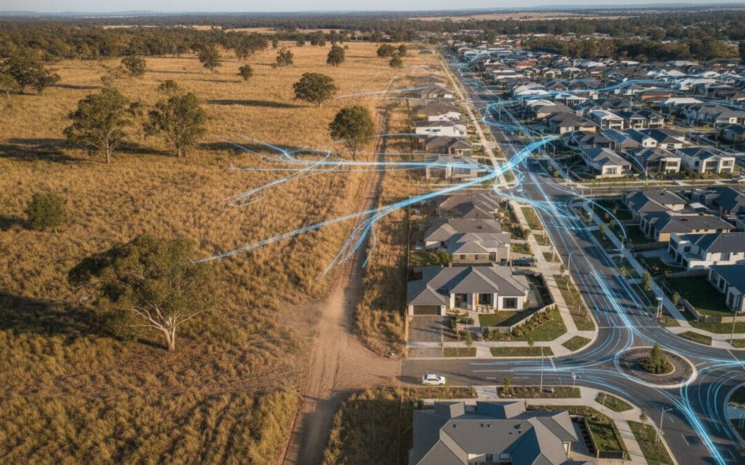
A simple rezoning application represents the difference between a significant land value uplift and a costly rejection, yet many developers fail to account for the “infrastructure gap” created by shifting land uses. When you transition a site from primary production to a residential or commercial hub, you aren’t just changing a boundary on a map; you’re fundamentally altering the regional road network. Assessing the traffic impact of rezoning agricultural land is a non-negotiable step that councils scrutinise with high precision to avoid future gridlock.
You likely recognise that rural roads weren’t designed for the high-volume trip generation rates of modern urban developments. It’s a common concern that your project might be stalled by technical objections or demands for expensive road upgrades. This article provides a clear path through the traffic engineering hurdles you’ll face. You’ll learn exactly how to support your proposal with a professional Traffic Impact Assessment (TIA) and discover the specific modelling required to turn a rural site into a compliant, high-value asset.
Key Takeaways
- Understand how transitioning land from primary production to higher-intensity use acts as a traffic catalyst that requires rigorous council scrutiny.
- Learn how to quantify the traffic impact of rezoning agricultural land by accurately modelling the shift from seasonal farm machinery to daily commuter peaks.
- Identify the critical safety factors, including sight distance assessments and road shoulder requirements, necessary to bridge the infrastructure gap on rural road networks.
- Recognise the role of a Traffic Impact Assessment (TIA) as the primary technical evidence required to prove your rezoning proposal is sustainable and compliant.
- Gain insights into using expert traffic engineering reports to provide hard data that addresses community concerns and facilitates land value uplift.
What is the Traffic Impact of Rezoning Agricultural Land?
The traffic impact of rezoning agricultural land represents the measurable shift in vehicle volumes and road safety risks when a site transitions from primary production to higher-intensity use. For local councils and road authorities, rezoning acts as a traffic catalyst. It fundamentally alters the purpose and performance of the local road network. While agricultural traffic is often seasonal and involves heavy machinery, rezoned residential or commercial developments introduce consistent, high-frequency vehicle movements that rural infrastructure was not originally designed to support.
Councils view traffic capacity as a primary deal-breaker for rezoning applications. If a proposal threatens to overwhelm existing intersections or degrade road safety, it’s unlikely to proceed. Proving that the surrounding network can absorb the new demand is a critical hurdle for any developer seeking a land-use change.
The Fundamental Shift in Land Use Intensity
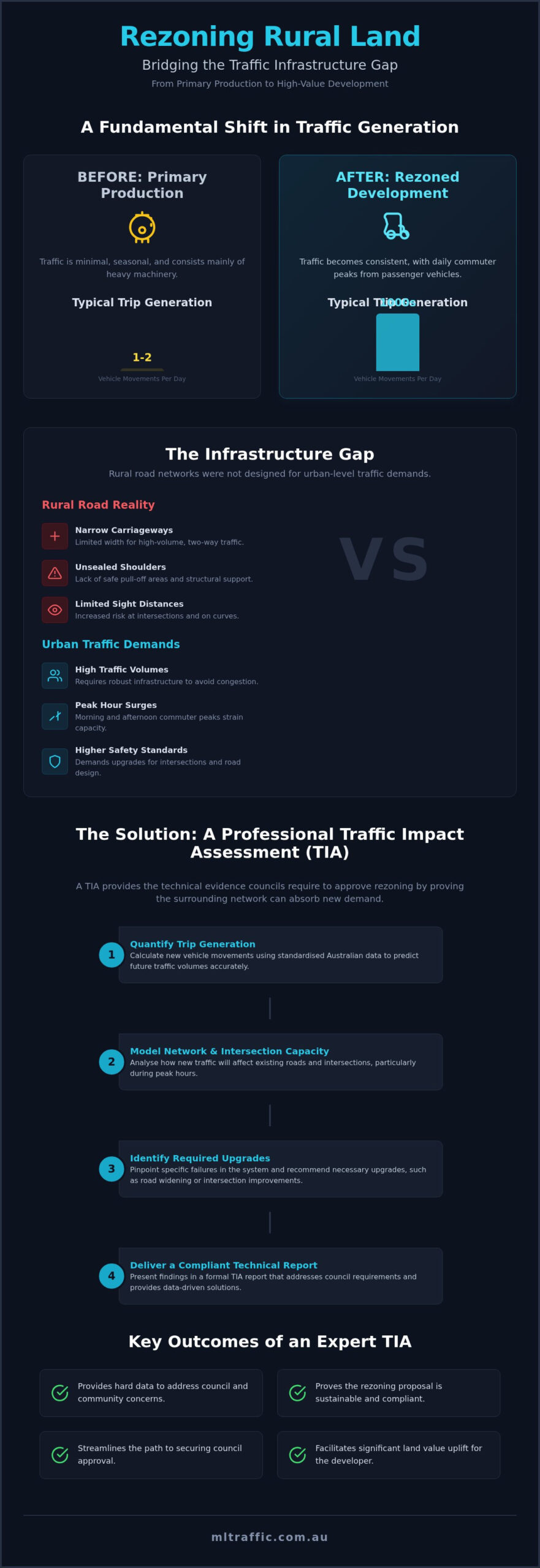
Agricultural operations typically generate minimal traffic. A grazing property might contribute only one or two vehicle movements per day. When that land is rezoned for residential “lifestyle” lots or commercial hubs, those numbers jump to hundreds or thousands of trips. This shift places urban-level expectations on rural settings.
Rural road networks often consist of narrow carriageways with unsealed shoulders and limited sight distances. These roads are functional for tractors, but they quickly become hazardous under the pressure of daily commuter peaks. The infrastructure gap between existing conditions and future demand must be bridged through expert analysis and design.
Why Councils Demand a Traffic Impact Assessment (TIA)
A formal assessment provides the technical assurance that the existing network can handle the predicted surge in volume. It identifies where the system might fail and what upgrades are necessary to maintain safety. These findings often dictate the level of developer contributions required for road widening or intersection improvements.
Engaging the services of ML Traffic Engineers Australia early in the planning phase ensures your proposal is grounded in technical reality. We prepare detailed TIA reports that address specific council requirements and support your application with empirical data. You can explore our full range of ML Traffic Engineers Australia services to see how we assist with complex land-use transitions.
Assessing Trip Generation: From Tractors to Daily Commutes
Predicting the traffic impact of rezoning agricultural land begins with a rigorous analysis of trip generation. This process involves calculating the number of new vehicle movements a proposed development will contribute to the local road network. While a farm may generate only a few heavy vehicle movements during harvest, a rezoned residential subdivision produces hundreds of passenger vehicle trips daily. Traffic engineers must account for these new volumes to ensure the surrounding infrastructure remains functional and safe.
The contrast between agricultural and urban traffic profiles is stark. Primary production traffic is often seasonal and low-frequency. Conversely, residential developments create high-frequency, predictable peaks during the morning and afternoon. If the land is rezoned for commercial use, such as a service station or tourism facility, the traffic profile changes again. These uses generate high turnover and constant vehicle movements throughout the day. A professional Traffic Impact Assessment (TIA) is essential to quantify these numbers and provide the hard data councils require.
Calculating Traffic Volume Increases
Engineers rely on standardised Australian data, such as nationally recognised guidelines for traffic generating developments and relevant technical directions, to maintain consistency. These guidelines provide specific trip generation rates for various land uses, including rural residential lots. We must also account for seasonal agricultural traffic that may continue to share the road. Predicting peak hour demand is critical, as this determines whether the existing network will reach capacity. Accurate modelling ensures that any infrastructure gaps are identified before the rezoning is approved.
Intersection and Network Capacity Modelling
Existing rural intersections, often simple T-junctions, frequently lack the capacity to handle urban-level traffic surges. Our modelling identifies when these junctions must be upgraded to roundabouts or signalised intersections to maintain safety. We assess the “Level of Service” (LoS), a qualitative measure ranging from A (free flow) to F (breakdown). If a rezoning proposal drops the LoS below acceptable council thresholds, mitigation strategies must be included in the report. For expert assistance with these technical requirements, you can contact our senior principals directly to discuss your site.
Navigating the Infrastructure Gap in Rural Rezoning
The “infrastructure gap” occurs when the technical capacity of a rural road network fails to meet the service requirements of urban-intensity development. When assessing the traffic impact of rezoning agricultural land, engineers often find that roads designed for low-volume farm access lack the structural and geometric integrity needed for hundreds of daily commuters. This discrepancy is a primary concern for councils. It requires detailed mitigation strategies to ensure the public road network remains safe and functional.
Beyond the final land use, the construction phase introduces significant heavy vehicle volumes to roads that may have narrow carriageways or unsealed shoulders. These roads must be evaluated for their ability to withstand increased axle loads without premature pavement failure. Any new access points or internal parking facilities must also strictly adhere to AS 2890.1 standards to guarantee compliant driveway grades and parking dimensions. Failing to address these infrastructure deficiencies early can lead to costly delays or project refusal during the Development Application (DA) process.
Road Safety and Sight Distance Assessments
Rural environments typically feature higher speed limits, often ranging between 80km/h and 100km/h. These speeds necessitate significantly longer sight distances for any new property access points compared to urban settings. Our assessments identify existing “black spots” or high-risk segments that could be worsened by the additional traffic volume. Safe Intersection Sight Distance (SISD) is a critical safety metric for DAs, defined as the distance a driver on the major road must see a vehicle entering from a side road or driveway to safely stop before a collision occurs.
Swept Path Analysis for New Access Points
New subdivisions or commercial hubs must accommodate more than just passenger cars. Waste collection vehicles and emergency services require sufficient space to turn and navigate the site without mounting kerbs or reversing into traffic. We use Swept Path Analysis to provide technical proof that these larger vehicles can safely access the site. By utilising AutoTURN software, our engineers validate road designs against Australian Standard vehicle templates. This data-driven approach provides councils with the assurance that the proposed layout is physically feasible and meets all operational requirements.
How to Organise a Traffic Impact Assessment for Rezoning
A Traffic Impact Assessment (TIA) serves as the primary technical evidence required to convince local councils and road authorities that a proposed land-use change is sustainable. Without a robust, data-driven report, the traffic impact of rezoning agricultural land remains speculative, which often leads to an automatic rejection by planning authorities. To ensure a smooth approval process, it’s essential to collaborate with experienced Traffic Engineers during the initial planning phase. This proactive approach prevents costly design revisions later and ensures the final TIA integrates seamlessly into your Statement of Environmental Effects (SEE).
Step 1: Data Collection and Site Analysis
The assessment process begins with a comprehensive site inspection and empirical data collection. We conduct 7-day pneumatic tube traffic counts on all adjacent roads to establish an accurate baseline of existing vehicle movements, including peak hour volumes and vehicle classifications. This step involves reviewing the local council’s road hierarchy and any future transport infrastructure plans for the region. Our engineers identify physical constraints such as narrow culverts, weight-limited bridges, or existing safety hazards that could limit the feasibility of the rezoning or require immediate remediation.
Step 2: Traffic Modelling and Impact Prediction
Once the baseline data is established, we use SIDRA Intersection software to predict the performance of the road network post-development. We input specific trip generation rates based on the proposed land use and test various “what-if” scenarios for different development densities. This modelling determines if the traffic impact of rezoning agricultural land will cause unacceptable delays or congestion for existing residents. The results provide a quantitative Level of Service (LoS) rating, giving councils the hard data needed to justify the capacity of the current network or the necessity of specific infrastructure upgrades.
Step 3: Mitigation and Design Recommendations
If the modelling identifies capacity or safety issues, the final report must include practical mitigation strategies. These recommendations often include intersection widening, the addition of dedicated turn lanes, or traffic calming measures to maintain network integrity. For the construction phase, we integrate detailed Traffic Management Plans to manage heavy vehicle movements and site access. Our goal is to provide a cost-effective solution for the developer that satisfies all council and road authority standards. To secure your council approval and maximise land value, explore our full range of traffic engineering services today.
Securing Approval with ML Traffic Engineers Australia
A rezoning application is a high-stakes technical negotiation with planning authorities that requires more than just a conceptual plan. A professional report from ML Traffic Engineers Australia is non-negotiable for this process. Councils require technical certainty that transitioning from primary production to higher-intensity use will not compromise regional network efficiency. Without this documentation, the perceived traffic impact of rezoning agricultural land becomes a primary reason for refusal. Expert modelling provides the only objective method to transform a developer’s vision into a legally compliant, approved reality.
Planning authorities must balance growth objectives against the long-term viability of public assets. If a proposal lacks a rigorous assessment of how new vehicle movements interact with existing rural road geometries, it will likely be deferred during the public exhibition phase. We provide the technical bridge between your land-use objectives and the council’s regulatory requirements. This proactive approach ensures that every potential technical hurdle is identified and mitigated before it becomes an insurmountable roadblock to your project’s success.
Overcoming Common Council Objections
Community pushback often centres on the fear of increased congestion. Local residents rarely distinguish between a simple increase in vehicle volume and an actual failure of the road network’s capacity. We use empirical data to prove that more cars don’t always result in unacceptable delays. By demonstrating how developer-funded intersection upgrades or road widenings benefit the wider community, we turn a potential deal-breaker into a net positive for the region. Our engineers provide authoritative, fact-based responses to Council Request for Information (RFI) letters, ensuring technical queries are resolved with professional precision and speed.
Partnering with ML Traffic Engineers Australia
Successful rezoning requires more than just standard software output; it demands seasoned expertise and a results-oriented approach to bureaucracy. ML Traffic Engineers Australia leverages over 15 years of experience in the Australian market to navigate complex regulatory environments. We maintain a consistent national track record of securing approvals for diverse and contentious land-use transitions across every state and territory.
A key signature of our consultancy is direct access to senior leadership. The expert who initiates your project is the same professional performing the technical analysis and signing off on the final report. This level of senior accountability ensures that your DA is supported by meticulous engineering and deep-seated industry knowledge. Our hands-on philosophy distinguishes us from larger, more impersonal firms. Contact the team today to discuss your agricultural rezoning project and secure the land value uplift you’ve planned for.
Maximising Land Value Through Technical Compliance
Successfully navigating a land-use transition requires more than just a vision for development; it demands technical precision. You now understand that the traffic impact of rezoning agricultural land is the primary metric councils use to determine if a project is sustainable and safe. By quantifying trip generation rates and identifying necessary safety upgrades early in the process, you transform a speculative proposal into a robust, compliant asset ready for council scrutiny.
ML Traffic Engineers Australia provides over 15 years of national experience to ensure your project meets every regulatory standard. Our senior principals are directly involved in every assessment, delivering comprehensive reports designed to facilitate rapid council approval and minimise the risk of costly RFIs. Don’t leave your land value uplift to chance or let technical hurdles stall your progress. Contact ML Traffic Engineers Australia to discuss your rezoning project and gain the professional support required for your site’s transition. With the right technical evidence, you can bridge the infrastructure gap and unlock the full potential of your land.
Frequently Asked Questions
Why does rezoning agricultural land require a traffic impact assessment?
Rezoning requires a TIA because it triggers a permanent shift in land-use intensity. Councils must verify that the existing road network can safely absorb the increased vehicle volumes without causing congestion or safety hazards. This assessment provides the technical justification for the land-use change and identifies any necessary infrastructure improvements to support the new development density.
Can I rezone my farm without upgrading the local roads?
You can only avoid road upgrades if your TIA proves the existing infrastructure has sufficient residual capacity to handle the new traffic demand. However, rural roads often lack the pavement strength or width required for urban-level traffic. If the traffic impact of rezoning agricultural land exceeds the current road’s Level of Service thresholds, council will likely mandate developer-funded upgrades as a condition of approval.
How much extra traffic does a new residential subdivision typically generate?
Traffic generation depends on the lot size and location, but standard Australian guidelines often cite approximately 7.4 to 9 daily vehicle trips per single dwelling. For a 50-lot subdivision, this equates to at least 370 new movements per day. This is a significant increase compared to a working farm, which may only generate a few trips daily, necessitating a detailed intersection analysis to manage peak-hour surges.
What is a SIDRA analysis and do I need it for my rezoning application?
SIDRA is a specialised software tool used by traffic engineers to model intersection capacity, delay, and Level of Service. You’ll need a SIDRA analysis if your rezoning application involves adding significant traffic to existing junctions. It provides the empirical evidence councils require to determine if an intersection can handle the new load or if it requires upgrading to a roundabout or signals.
Will council reject my rezoning if the local bridge is too narrow for trucks?
A narrow bridge is a significant constraint but not an automatic deal-breaker if a viable mitigation strategy is provided. Council will scrutinise the safety and structural capacity of the bridge to handle increased passenger and service vehicle traffic. Your traffic report must address these constraints through swept path analysis or by proposing infrastructure contributions to widen or reinforce the existing structure.
How long does it take to prepare a Traffic Impact Assessment for rezoning?
A comprehensive TIA typically takes four to six weeks to complete. This timeframe includes the mandatory seven-day traffic counts, site inspections, and complex SIDRA modelling. Large-scale or contentious rezoning projects may require additional time for consultation with state road authorities to ensure all regional impacts are addressed and all technical requirements are satisfied before submission.
Do I need a separate traffic report for the construction phase of the project?
Yes, councils usually require a Traffic Management Plan (TMP) or Traffic Guidance Scheme (TGS) specifically for the construction phase. While the TIA focuses on the long-term traffic impact of rezoning agricultural land, a construction-specific report manages heavy vehicle access, worker parking, and road safety during the build. This ensures that the high volume of construction machinery doesn’t disrupt the local community.
What is the difference between a Traffic Impact Statement and a full TIA?
A Traffic Impact Statement is a simplified report used for small-scale developments with minimal network impact. In contrast, a full Traffic Impact Assessment (TIA) is a comprehensive document required for rezoning or large subdivisions. The TIA includes detailed intersection modelling, long-term network growth predictions, and extensive safety assessments, providing the depth of data needed for high-intensity land-use changes.

Disclaimer
The content on www.mltraffic.com.au, including all technical articles, guides, and resources, is provided for general informational and educational purposes only. It is not intended to constitute professional advice in traffic engineering, transportation planning, development approvals, or any other technical or legal field.
While ML Traffic Engineers makes every reasonable effort to ensure the accuracy, completeness, and timeliness of the information published, we do not provide any warranties or representations (express or implied) regarding its reliability, suitability, or availability for any particular purpose. Any reliance you place on the content is strictly at your own risk.
In no event shall ML Traffic Engineers, its directors, employees, authors, or affiliates be liable for any direct, indirect, incidental, special, consequential, or punitive damages (including, without limitation, loss of profits, data, or business opportunities) arising out of or in connection with the use of, or inability to use, any information provided on this website.
The articles and guides on this site are not a substitute for engaging a qualified, registered professional traffic engineer (such as an NPER or RPEQ engineer) to assess your specific project requirements. For tailored advice, compliance assessments, or traffic engineering services, please contact a competent professional.
This disclaimer may be updated from time to time without notice. By accessing or using this website, you agree to be bound by the most current version of this disclaimer.
